
Stitching the Wild Back Together: Practical Corridor Design for Fragmented Wildlife
The Invisible Fences Dividing Our Living Landscapes
Habitat fragmentation is often imagined as a problem confined to distant forests cut apart by highways. In practice, it begins much closer to home. A housing development can interrupt a hedgerow, a widened road can sever a wetland from its breeding pond, and a chain of mown lawns can make a suburban edge nearly impassable for animals that need cover. Working farms, drainage ditches, rail rights of way, utility corridors, and commercial districts all form part of the landscape through which wildlife must move.
When populations become isolated, the consequences extend beyond fewer sightings. Animals may lose access to seasonal feeding grounds, nesting sites, mates, and refuge from extreme weather. Over time, restricted movement can reduce genetic exchange and leave small populations more vulnerable to disease, inbreeding, and local environmental change. The practical response is not always the purchase of vast new reserves. A more durable strategy combines protected core habitat with a permeable surrounding matrix, using small bridges between larger ecological areas. Even a modest strip of native vegetation, a safer culvert, or a connected line of ponds can restore movement that infrastructure has quietly blocked.
Rethinking Permeability Across Human Dominant Spaces
A reserve can protect an important patch of habitat, but a reserve is not automatically a functioning landscape. Wildlife leaves protected areas to forage, disperse, reproduce, and respond to seasonal conditions. The surrounding matrix may contain roads, yards, crops, drainage channels, and industrial land, each presenting a different level of resistance. Landscape permeability asks a practical question: how difficult is it for a particular species to cross the whole area?
This perspective complements, rather than replaces, the protection of core habitat and major corridors. A wolf may cross several land-cover types over a long distance, while a salamander may require damp leaf litter, low traffic exposure, and close spacing between breeding pools. A movement route that works for one species may be useless or dangerous for another. Planning should therefore identify species-specific thresholds, such as maximum road exposure, minimum vegetation cover, access to water, and tolerance of lighting or noise.
Suburban edges and working landscapes should be treated as ecological design spaces rather than blank gaps between reserves. A rights of way may support grasses and pollinators if mowing is timed appropriately. A farm lane may become safer when dense cover is retained on both sides. A neighborhood drainage swale can connect gardens, wetlands, and stream margins if it is planted with native species and kept free of unnecessary lighting. Useful principles include:
- Map movement needs by species and life stage, not only by land ownership.
- Reduce the strongest barriers first, especially high-speed roads, steep drainage structures, and exposed gaps between habitat patches.
- Provide continuous cover, moisture, and food wherever possible, while avoiding designs that attract animals toward traffic.
- Use several small connections instead of relying on one narrow route that can fail during drought, construction, or disturbance.
Subterranean Paths and Small Scale Engineering for Amphibians
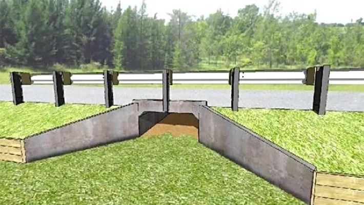
Road mitigation often focuses on large mammals because their collisions are visible and costly. Smaller vertebrates face a different set of problems. Amphibians may migrate during rainy nights, crossing roads between woodland shelter and temporary breeding pools. A tunnel that is technically open may still fail if it is dry, brightly lit, flooded, too wide and exposed, or separated from the surrounding habitat by a curb.
Effective amphibian passage begins with local observations. Mark the points where animals already gather, particularly near seasonal wetlands, forest edges, and roadside depressions. A passage should maintain a humid microclimate, provide textured surfaces for climbing, and connect directly to safe cover. Directional fencing can guide animals toward an entrance, but it must be buried or sealed sufficiently to prevent animals from slipping underneath. Fences also require escape features or carefully designed ends so that they do not create a trap.
| Design element | Practical purpose |
|---|---|
| Damp, textured tunnel floor | Maintains traction and reduces desiccation during migration |
| Continuous directional fencing | Guides animals away from pavement and toward the crossing |
| Retrofitted culvert ledge or shelf | Provides a passable route during moderate water flow |
| Vegetated tunnel approaches | Offers shade, cover, and a gradual transition into habitat |
| Seasonal inspection and maintenance | Removes debris, repairs gaps, and confirms that flooding has not blocked passage |
Retrofitting an existing culvert can be more achievable than building a new crossing. Road commissions, municipal engineers, watershed groups, and landowners can share costs and responsibilities. A project may begin with a short demonstration site at a known mortality hotspot, followed by monitoring during the migration season. Federal technical guidance on wildlife crossing structures offers useful benchmarks for adapting roadway infrastructure to wildlife passage, including non-game species. The design should always be reviewed against local hydrology, road safety requirements, maintenance access, and the needs of the target species.
Working Farmlands as Active Ecological Seams
Farmland does not have to function as an ecological blank space between reserves. Hedgerows, stream margins, windbreaks, drainage edges, and uncultivated corners can form a connected network when they are planned as parts of one system. A hedgerow that links a woodland to a riparian buffer gives small mammals, insects, and birds a sheltered route. A vegetated stream edge can provide cover while reducing erosion, filtering runoff, and stabilizing soil.
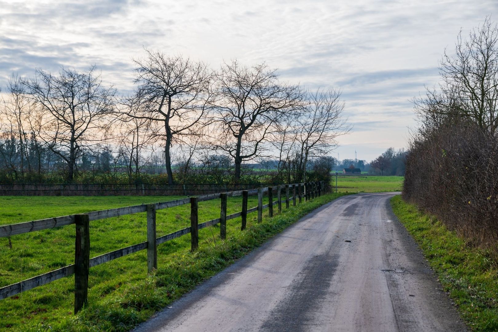
Plant selection should be layered rather than ornamental. Tall native shrubs can provide nesting cover and winter protection, while lower shrubs, perennial flowers, grasses, and ground-layer plants extend food availability across seasons. Species should be chosen for the local soil, water regime, and climate, with attention to flowering periods, fruit production, seed-bearing stems, and dense root systems. A corridor that offers food only in spring may still leave a serious summer or winter gap.
- Use trees and tall shrubs where canopy continuity and wind protection are important.
- Combine mid-height shrubs with native grasses to create cover close to the ground.
- Include early, mid-season, and late-season flowering plants for pollinators and other invertebrates.
- Protect wet edges with species suited to periodic flooding rather than forcing drainage or intensive mowing.
- Coordinate mowing, tillage, and hedge trimming so that maintenance does not remove the corridor during peak nesting or migration periods.
Conservation easements and land trust agreements can provide the long-term security that voluntary plantings sometimes lack. A farm buffer agreement should define the protected area, permitted management, access responsibilities, invasive plant control, and procedures for future ownership changes. Flexibility matters because farming practices and climate conditions change. The strongest agreements protect the continuity of the buffer while allowing adaptive stewardship, such as replacing failing plants, widening a wetland edge, or changing mowing schedules.
A Framework for Designing Local Movement Networks
Local connectivity work becomes more effective when it follows a clear sequence. The goal is not to draw an attractive line on a map, but to identify where a specific barrier prevents animals from reaching habitat that already exists. A small intervention at the right location can be more valuable than extensive planting in an area that wildlife does not use.
- Map local movement choke points. Combine municipal habitat maps, roadkill records, wetland inventories, land trust knowledge, and regional community science observations. Look for repeated collision locations, gaps between ponds, abrupt breaks in hedgerows, and places where animals are funneled toward roads. Community observations are most useful when dates, species, weather, and exact locations are recorded consistently.
- Engage the people who control the ground. Property owners, farmers, neighborhood associations, road commissions, parks departments, transit agencies, and utility managers may each control a small portion of the route. Early conversations can reveal maintenance constraints and identify opportunities, such as planting during a scheduled road project or incorporating a passage feature into culvert replacement.
- Establish a low-cost pilot linkage. Begin with native plantings, brush-free sight lines, temporary guidance fencing, reduced mowing, or small wetland improvements. A pilot should have a defined target, a maintenance plan, and a baseline record of conditions before construction. Physical barriers must be designed carefully so that they direct wildlife toward safe passage rather than concentrating animals at another road edge.
- Monitor movement and biological response. Motion-sensor cameras can document use, while track plates, acoustic surveys, amphibian counts, vegetation plots, and roadkill records provide complementary evidence. Multi-year monitoring is important because animals may need time to discover a new route and because successful movement is not the same as long-term population recovery. Empirical biological assessments indexed through multi-year conservation research illustrate why repeated surveys and biological indicators are needed to evaluate whether a corridor is functioning.
Monitoring should measure both the passage and the surrounding system. A camera may show animals entering a culvert, but vegetation surveys can reveal whether the approaches remain connected. Genetic sampling, where appropriate and ethically justified, can help determine whether individuals from separated populations are breeding across the linkage. Results should feed back into management. A blocked entrance, failed plant species, excessive lighting, or a new traffic pattern is not evidence that connectivity is impossible; it is information for the next design adjustment.
Weaving Every Acre into the Larger Matrix
Functional connectivity is built through many decisions that appear modest on their own. A culvert shelf, a restored hedgerow, a protected farm buffer, and a planted drainage edge may each serve a small area, yet together they can reconnect seasonal habitat and reopen routes for dispersal. The most valuable projects are strategic: they remove a known barrier, reinforce an existing movement path, or close a gap between habitats that are already within reach.
Local land trusts can secure continuity, civil engineers can make infrastructure safer, farmers can manage working edges as living buffers, and backyard advocates can reduce gaps in the neighborhood matrix. Regional resilience will not arrive through one perfect corridor. It will emerge from patient coordination, sound monitoring, and repeated care for the places where pavement, soil, water, and habitat meet. Building one practical linkage at a time gives fragmented wildlife a better chance to move, reproduce, and remain part of a living landscape.
By Magnus
- 15, Nov, 2026
- 0 Comments