The Living Underground: What Nematodes and Soil Microbes Reveal About Land Health

Beneath the Surface of Standard Soil Chemistry

A conventional soil test can tell you important things about acidity, available nitrogen, phosphorus, potassium, salinity, and sometimes organic matter. Yet those numbers provide only a partial view. A field may show an acceptable nutrient reading while still suffering from compaction, poor aggregation, weak root growth, low microbial activity, or a disrupted soil food web. In that situation, nutrients may be present but poorly cycled, easily leached, or unavailable when plants need them most.

Soil is better understood as a living network than as an inert chemical sponge. Roots release carbon compounds into the rhizosphere, fungi extend through pores, bacteria process fresh organic matter, protozoa and nematodes graze on microbial populations, and larger organisms redistribute nutrients through the soil profile. The Natural Resources Conservation Service guidance on living soil describes soil health as the continuing capacity of soil to function as a vital ecosystem that sustains plants, animals, and people. That perspective shifts attention from isolated fertilizer applications toward the organisms that build structure, regulate nutrient release, retain water, and help land recover from stress.

The Microscopic Food Web Powering Nutrient Cycles

Nematodes are among the most useful organisms for seeing this underground economy. They are microscopic, thread-shaped animals occupying several feeding levels. Bacterial-feeding nematodes consume bacteria that have multiplied around fresh roots, manure, compost, and other carbon sources. Fungal-feeding nematodes graze on fungal hyphae, while predatory and omnivorous species feed on other nematodes and small soil organisms. As these animals digest their food, nutrients held in microbial biomass are released in forms that plants can more readily access.

Protozoa perform a related grazing function. By feeding on bacteria, they accelerate the movement of nitrogen and other nutrients through the rhizosphere. Predatory nematodes and other higher-level consumers add regulation. They can reduce the dominance of particular microbial populations and help prevent any one group from overwhelming the food web. This does not mean that every predator directly eliminates a crop pathogen. Rather, a diverse community creates competition, consumption, and habitat complexity that can make disease-promoting conditions less likely.

A review in soil nematode research identifies abundance, diversity, feeding groups, life-history strategies, and metabolic activity as useful indicators of disturbance and soil function. Broader ecological investigations demonstrate how microbial community balance and microfaunal grazers stabilize nutrient availability under changing environmental conditions. For field interpretation, the key biological guilds include:

  • Bacterial feeders, which help process readily available carbon and contribute to mineral nitrogen release.
  • Fungal feeders, which participate in decomposition pathways often associated with more complex plant residues and stable soil structure.
  • Predatory and omnivorous nematodes, which signal a more developed food web and provide top-down regulation.
  • Plant-parasitic nematodes, which can indicate crop stress and, at high levels, directly damage roots.
  • Decomposer fungi and bacteria, which transform residues into microbial biomass, humus-like compounds, and nutrients that can be retained in aggregates.

Healthy soil does not require the complete absence of plant-parasitic nematodes or any single microbial group. Function depends on balance, habitat, and context. A biologically active soil may contain potential pests, but diverse roots, predators, competing microbes, and adequate organic matter can prevent those populations from becoming dominant. This is why nematode community structure is more informative than a single organism count.

Subterranean Architecture Across Grasslands and Degraded Cropland

Intact prairie offers a useful reference because it combines continuous living roots, varied plant chemistry, deep rooting patterns, and minimal disturbance. Those conditions tend to support a layered pore system and a diverse microbial habitat. Fungal networks can bind particles into aggregates, while roots and decaying channels create pathways for air and water. Heavily tilled or intensively fertilized cropland may still produce strong short-term yields, but repeated disturbance and limited plant diversity can reduce habitat continuity, weaken aggregates, and simplify the organisms responsible for nutrient cycling.

Research teams studying Missouri and Kansas prairie soils are comparing microbial communities from relatively undisturbed grasslands with those from heavily farmed land. A landmark microbial ecology study examining root pathogen diversity across these grassland climate gradients demonstrates how environmental filtering, land disturbance, and host specificity fundamentally alter fungal and oomycete community composition. These projects are investigating how soil microbiomes influence plant diversity, fertility, and resilience under altered rainfall patterns. The contrast should not be treated as a simple choice between prairie and production. Instead, it offers a design lesson: farms can borrow ecological functions from grasslands by maintaining living roots, diverse plant communities, and fewer disruptive events.

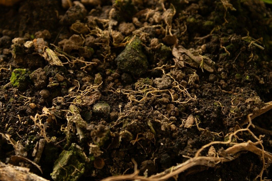
Cross-section of a lush grass turf block showing layered soil beneath
Continuous roots and protected soil layers create the habitat needed for nutrient cycling, water storage, and recovery from environmental stress.
Management setting Aggregate stability and porosity Biological community Root matrix integrity
Intact or well-restored prairie Usually more continuous pore networks and stronger aggregate protection High plant and microbial diversity, with multiple nematode feeding groups Deep, overlapping roots provide habitat across seasons
Diverse perennial pasture Often good surface cover and improving structure, depending on grazing and traffic Mixed bacterial and fungal pathways supported by varied residues Persistent roots shelter organisms during dry or hot periods
Annual rotation with cover crops Potentially improving, especially when residue remains and tillage is reduced Greater seasonal food supply than a bare fallow system Root continuity depends on rotation timing and cover-crop survival
Repeatedly tilled, simplified cropland More vulnerable to crusting, compaction, erosion, and rapid aggregate breakdown Often reduced diversity and a greater dependence on external nutrient inputs Short-lived root habitat with exposed periods between crops

Deep-rooted plants are especially important during climatic extremes. Their roots open channels below the surface, while living cover shades soil and reduces evaporation. During wet periods, connected pores help water move downward rather than run across the field. During drought, protected aggregates and deeper roots improve access to stored moisture. The result is not immunity from climate stress, but a larger margin for recovery.

Field Diagnostics to Read Biological Activity on Your Land

Field observations cannot replace laboratory analysis, but they can reveal patterns quickly and inexpensively. A useful assessment combines physical, chemical, biological, morphological, and visual indicators rather than relying on yield or one nutrient measurement. Always compare similar soil types, seasons, and moisture conditions. A wet, compacted sampling day and a dry, well-aerated sampling day will produce different impressions even when management has not changed.

An aggregate slump test offers a simple view of structural stability. Place several intact soil aggregates in a transparent jar or container of water and observe them over several minutes. Stable aggregates retain their shape, while weak aggregates disperse into cloudy sediment. The test is comparative rather than diagnostic: sample a high-performing area, a field average, and a visibly degraded patch. Bait-lamina strips provide another field-accessible measure. These narrow strips contain small portions of plant material and are inserted vertically into the soil. After a defined exposure period, the number of consumed bait points gives an indication of soil-feeding activity. Because activity can be low and uneven, replicate strips are essential, as field evaluation has shown.

  1. Map the land into management zones. Separate paddocks or fields by soil type, slope, drainage, crop history, traffic pattern, and visible productivity. Include both strong and weak areas rather than sampling only convenient locations.
  2. Record baseline conditions. Note recent rainfall, soil moisture, temperature, crop stage, grazing pressure, tillage, fertilizer applications, and ground cover. Photograph the surface before digging.
  3. Inspect a consistent soil volume. Dig a spade-sized section and examine aggregate shape, pore spaces, roots, earthworm channels, compaction layers, residue breakdown, and root color. Look for rhizosheaths, the soil particles that cling closely to fine roots and indicate active root-soil contact.
  4. Repeat simple biological tests. Use aggregate slumps, bait-lamina strips, earthworm counts, and residue observations at the same locations or within marked zones. Replication matters more than a single impressive sample.
  5. Send selected samples for laboratory analysis. Where possible, request organic matter, microbial biomass or respiration, and nematode community analysis alongside standard chemistry. A nematode report is most useful when it separates feeding groups and plant-parasitic forms.
  6. Review trends over time. Compare measurements seasonally and annually. Look for improving aggregation, deeper roots, faster but not excessive residue turnover, more earthworm channels, and a broader biological community.

Root inspection deserves particular attention. Healthy roots often show branching, fine root hairs, firm texture, and close contact with surrounding soil. Rhizosheaths can indicate an active rhizosphere, while frequent earthworm burrows suggest channels for air, water, and root exploration. Conversely, horizontal compaction layers, smeared pore walls, dark or decaying roots, and abrupt changes in root depth point toward physical or biological constraints that a nutrient test alone may miss.

Practical Interventions to Restore Underfoot Ecosystems

Restoration begins with reducing the conditions that repeatedly damage habitat. Excessive or poorly timed synthetic fertilizer can create nutrient imbalances, acidification, salt stress, and rapid microbial shifts, although mineral nutrients remain useful when applied according to crop demand and soil evidence. The strongest approach is usually balanced rather than ideological. A review of balanced fertilization reports that combining organic and mineral sources can increase microbial biomass, enzyme activity, nutrient retention, and resilience, while replacing part of mineral fertilizer with organic inputs may reduce losses without sacrificing yields in suitable systems.

  • Match nutrients to real demand. Use soil tests, crop removal estimates, tissue observations, and yield goals to avoid routine applications that exceed plant needs.
  • Feed the food web gradually. Apply mature compost, well-managed manure, crop residues, or other organic materials at rates suited to soil texture, drainage, and nutrient budgets.
  • Keep roots present. Avoid unnecessary bare fallow periods and establish cover crops early enough for meaningful root development.
  • Protect the surface. Residue and living cover reduce temperature swings, erosion, crusting, and moisture loss.

Multi-species cover crops create a wider range of habitats and carbon sources than a single species. Grasses can contribute fibrous roots and persistent residues; legumes can add biologically fixed nitrogen; brassicas may create large taproots and channels; and broadleaf species can diversify root exudates and microbial associations. The correct mixture depends on climate, livestock, planting window, termination method, and weed risk. Diversity is not a seed-count competition. A smaller mixture with species that establish reliably is more valuable than a complicated blend that fails to produce living cover.

Disturbance management is equally important. Tillage physically breaks hyphal networks and exposes organic matter to rapid oxidation. Heavy equipment on wet soil can compress pore space beyond the reach of shallow roots. Intensive grazing can remove cover and compact the surface if animals remain too long under unsuitable conditions. Reduced disturbance, managed traffic, rotational grazing where appropriate, and adequate recovery periods allow biological networks to rebuild. The NRCS identifies reduced disturbance, maximized soil cover, biodiversity, and living roots as central soil-health practices because they work together rather than as isolated techniques.

Cultivating the Underground Legacy of Tomorrow

Microfaunal abundance does not function as a single magic score, and more organisms are not automatically better in every situation. The useful signal lies in diversity, feeding structure, activity, and change over time. A soil with active bacterial and fungal pathways, predatory nematodes, stable aggregates, deep roots, and continuous cover is generally better positioned to cycle nutrients, retain water, and recover from drought. Those functions can reduce dependence on purchased inputs, improve nutrient-use efficiency, and protect the productive capacity of land across difficult seasons.

Begin with a baseline this season. Mark representative sites, photograph soil and roots, perform aggregate and earthworm observations, test biological activity with replicated bait-lamina strips, and pair field notes with laboratory chemistry where resources allow. Then choose one manageable intervention, such as extending living cover, reducing traffic on wet ground, diversifying a rotation, or recalibrating fertilizer applications. Revisit the same sites after a year. Long-term stewardship becomes visible when success is measured not only in yield, but also in porosity, roots, organisms, water movement, and the capacity of the land to support future generations.
Restoring the Edge: Why Riparian Buffers Matter for Freshwater Health

The Living Border Between Land and Water

Headwater streams are the small, easily overlooked channels that form the circulatory system of entire freshwater drainage networks. They collect rainfall, connect wetlands and ponds, feed larger rivers, and carry the combined effects of every field, road, lawn, and neighborhood within the watershed. Because they are narrow and often close to homes or working land, changes along their banks can quickly influence water quality far beyond the original property.

A riparian zone is therefore much more than a decorative strip of greenery beside a creek. It is a dynamic biological membrane where land and water exchange nutrients, moisture, shade, organic matter, and habitat. Trees, shrubs, grasses, soil organisms, and roots work together to slow runoff, capture sediment, regulate temperature, and hold unstable banks in place. A planting decision made along a few meters of stream edge can contribute to basin-wide resilience by reducing the severity of heat, drought, and stormflow impacts downstream.

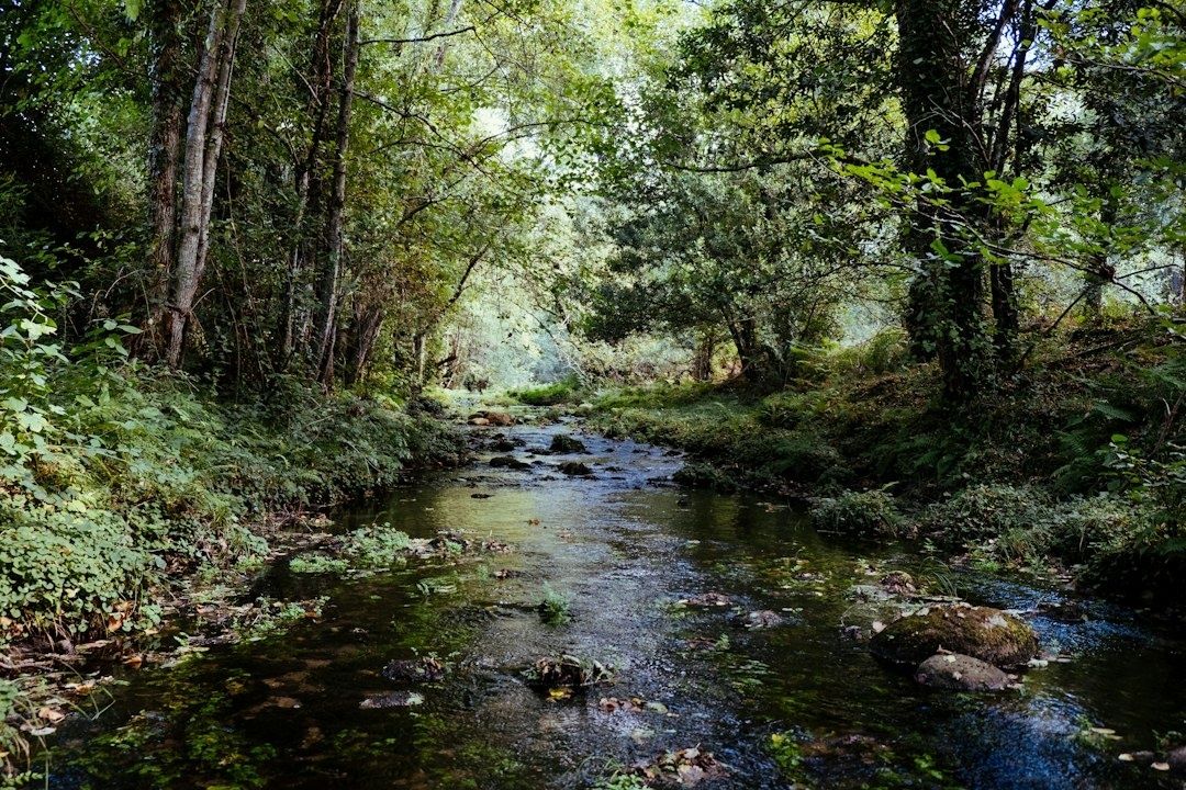
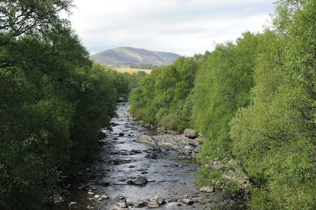
Tree-lined rocky stream flowing toward a green mountain valley
Healthy riparian plantings connect bank stability, water-quality protection, and habitat across the entire watershed.

Thermal Regulation and the Power of Canopy Shade

Sunlight is essential to life, but excessive solar exposure can rapidly warm a shallow headwater stream. As water temperature rises, its capacity to hold dissolved oxygen declines. Warm conditions can also increase the metabolic demands of fish and aquatic invertebrates, leaving less oxygen available precisely when animals need more of it. Cold-water species such as trout and salmon are particularly vulnerable when shaded reaches are replaced by open banks, closely mown turf, or bare soil.

Riparian trees and shrubs moderate this problem by intercepting sunlight before it reaches the channel. Their canopies also cool the surrounding air, reduce evaporation, and help maintain a more stable bank-side microclimate. Monitoring in southern England found that daily temperature peaks in shaded reaches were typically about 5 degrees Celsius cooler than in open water. The research indicated that approximately 20 percent canopy cover extending for at least 500 meters along small, rain-fed streams could prevent current summer maximum temperatures from reaching potentially life-threatening levels for native cold-water fish. The full findings are available in Forest Research”s study of riparian shade.

Evidence from coastal British Columbia also illustrates the protective value of retaining buffers during forest harvesting. In a replicated paired-catchment study, streams without riparian buffers experienced summer daily maximum temperature increases of as much as 2 to 8 degrees Celsius, while streams with 10-meter or 30-meter buffers showed no marked warming. Results vary with channel orientation, width, depth, canopy height, and local climate, so no single buffer measurement fits every site. The broader lesson is consistent: connected shade along small channels can prevent short, intense thermal spikes and extend the benefits downstream through agricultural and urban reaches.

  • Retain mature trees where they are healthy and do not threaten people or infrastructure.
  • Plant a mixture of native trees and shrubs to create shade at different heights and across different seasons.
  • Protect young plants from browsing, mowing, soil compaction, and repeated flood damage during establishment.
  • Inspect sunny gaps, especially on south-facing banks, where heat exposure may be greatest.

Root Architecture as Subsurface Structural Engineering

Streambank stability depends on more than what can be seen above ground. Roots bind soil particles together, reinforce the bank like a living mesh, and create channels that allow water and air to move through the soil. Fine, fibrous roots are particularly effective near the surface, where they resist raindrop impact and shallow erosion. Deeper roots from trees and larger shrubs can anchor soil farther into the bank, helping resist slumping when the channel rises rapidly.

Turf grass can protect exposed soil from some forms of surface erosion, but its relatively shallow root system often provides less structural reinforcement than a diverse community of woody perennials, grasses, sedges, and forbs. Native vegetation also slows runoff before it reaches the stream. When water travels through a rough, vegetated surface, its velocity falls, giving sediment and attached pollutants more opportunity to settle. By contrast, compacted lawns, bare paths, and concentrated drainage outlets can deliver fast-moving water directly to the bank, increasing shearing forces during storms.

Bank condition Likely effect during runoff Useful restoration response
Closely mown turf with shallow roots Limited reinforcement and faster surface flow Reduce mowing and introduce deeper-rooted native plants
Diverse shrub and tree zone Greater soil binding, roughness, shade, and organic matter Protect natural regeneration and fill persistent gaps
Bare or compacted bank High runoff velocity and increased risk of rilling or slumping Redirect concentrated flow and establish vegetation with suitable site protection
Unstable, actively migrating channel Potential failure beyond the capacity of ordinary planting Seek geomorphic assessment and qualified technical advice

During high-volume stormflow pulses, natural bioengineering can make the difference between a bank that bends and one that collapses. Planting alone is not a cure for every erosion problem. Large unstable channels, undercut banks, failing culverts, and concentrated drainage may require professional assessment before any work begins. In those settings, poorly placed trees or rigid structures can redirect flow and worsen damage. A sound plan matches root depth, plant community, and bank treatment to the channel”s shape, soil, flood frequency, and expected loads.

The Multi-Tiered Design of an Effective Buffer System

The strongest buffers are designed as layered systems rather than narrow rows of identical trees. The Natural Resources Conservation Service describes Riparian Forest Buffer practice 391 as a treatment using trees and or shrubs beside and up-gradient from a watercourse or water body. Its purposes include reducing sediment, nutrients, chemicals, pesticides, and pathogens reaching surface and ground water, while also improving habitat, storing carbon, lowering stream temperatures, and restoring riparian plant communities. Landowners should consult the applicable state or local technical guidance, because the national standard is not intended to be used by itself to design or install a project. The current framework is outlined in the NRCS Conservation Practice Standard 391.

A practical three-tier structure gives each part of the buffer a distinct job. The streamside tree zone is closest to the top of bank and supplies shade, large roots, leaf litter, and eventually woody debris. The transitional shrub zone adds dense stems and flexible root systems that trap sediment and tolerate conditions too wet, bright, or disturbed for mature forest trees. The upland filter strip, usually made up of grasses and herbaceous plants, slows sheet flow before it reaches the woody zones. In agricultural settings, this outer tier is especially important where runoff approaches the stream from cropland or compacted ground.

  1. Read the site before planting. Identify the ordinary top of bank, flood-prone areas, concentrated flow paths, wet soils, existing native regeneration, invasive plants, utilities, fences, and access needs.
  2. Assign functions to each tier. Place deep-rooted trees and shrubs where shade, bank reinforcement, habitat, and woody debris are priorities. Use dense grasses and herbaceous cover where sediment settling and safe mowing access are needed.
  3. Set width according to risk and purpose. A general minimum of 35 feet is associated with sediment, habitat, and carbon objectives in the NRCS material, while targeted pollutant treatment may require 50 feet or an associated practice. Steeper slopes, saturated soils, longer runoff paths, wildlife goals, and temperature concerns may justify additional width.
  4. Document establishment and maintenance. Record species, quantities, spacing, planting dates, protection measures, expected survival, and inspection responsibilities. Replace dead plants, control invasive species, and prevent damaging access or grazing.

Width should not be treated as a rigid number measured identically along every parcel. A buffer on a gentle, permeable slope with dispersed runoff may perform well at a different width from one on steep, compacted soil receiving concentrated flow. In Vermont guidance, for example, Zones 1 and 2 together have a 35-foot minimum, while a grass or herbaceous Zone 3 may be required where cropland sheet flow approaches the buffer. Nutrient treatment and wildlife objectives can call for widths of at least 50 feet or more. The right design follows the water, not simply the property line.

Community-Scale Stewardship and Practical Field Implementation

Successful restoration begins with species suited to the site rather than a generic list of attractive plants. Select native pioneers that tolerate seasonal inundation, saturated soils, summer drought, ice, browsing, and local disease pressures. A diverse mix of trees, shrubs, sedges, grasses, and flowering herbaceous plants spreads risk across seasons and weather conditions. It also creates more varied habitat than a single-species planting, while different root depths occupy different layers of the soil.

Early maintenance often determines whether a buffer becomes self-sustaining. Young plants may need shelters or fencing where deer, livestock, or other herbivores are abundant. Competing invasive plants should be controlled before they overtop new seedlings, but weed suppression must avoid disturbing the soil or sending herbicides into the channel. Mulch can reduce competition and conserve moisture where appropriate, although it should not be placed in a way that washes into the stream. During the first several growing seasons, inspections after droughts, floods, and heavy browsing help reveal which species and planting locations are working.

  • Map ownership, access points, drainage outlets, and existing native vegetation before organizing a planting day.
  • Coordinate with neighbors so isolated plantings can become a continuous corridor rather than disconnected patches.
  • Use written maintenance agreements that identify who will mow, remove guards, replace failed plants, and monitor invasive species.
  • Keep machinery, livestock, and routine foot traffic out of the most vulnerable streamside zone.
  • Track simple indicators such as surviving stems, canopy development, exposed soil, bank undercutting, water temperature, and visible sediment.

Volunteer watershed alliances can make this work more durable by coordinating nurseries, technical advice, monitoring, and shared equipment across multiple parcels. Municipal watershed managers can support continuity through setback policies, conservation incentives, stormwater planning, and public access designs that protect rather than fragment sensitive banks. Individual owners do not need to restore an entire watershed alone. A sequence of linked projects can gradually reconnect habitat, reduce cumulative runoff, and create a corridor capable of handling both ordinary seasons and increasingly extreme weather.

Rebuilding Living Watersheds One Stream Reach at a Time

Every planted linear foot along a headwater boundary contributes to a larger protective network. One restored bank can shade a cold-water refuge, hold soil during a cloudburst, or capture nutrients that would otherwise move into a pond, river, or drinking-water reservoir. The effect becomes more powerful as neighboring landowners protect adjacent reaches and as municipalities align road drainage, stormwater infrastructure, and conservation planning with the natural movement of water.

The essential shift is from passive neglect to active, science-grounded renewal. Start by inspecting the local stream edge after both a dry spell and a heavy storm. Look for bare soil, failing banks, sunny gaps, invasive plants, concentrated runoff, livestock access, and places where natural seedlings are already establishing. Then seek site-specific guidance before planting, particularly where channels are unstable or drainage is concentrated. A healthy riparian buffer is not finished when the plants go into the ground. It is a living piece of infrastructure that grows, adapts, and protects freshwater through years of careful stewardship.

Phenology in Practice: Documenting the Shifting Calendars of Native Pollinators

When Spring Arrives Ahead of Its Gardeners

Spring rarely announces itself with a single dramatic event. It gathers quietly along a forest floor, in the swelling buds of a backyard shrub, and in the first warm hours when a solitary bee leaves its sheltered nest. A trout lily opens after sunlight reaches its petals. A maple unfurls leaves. A small mining bee appears above a patch of bare soil. Each observation is modest on its own, yet together these events form a local seasonal calendar. Recording that calendar is a practical way to understand how weather and climate are reshaping the living landscape.

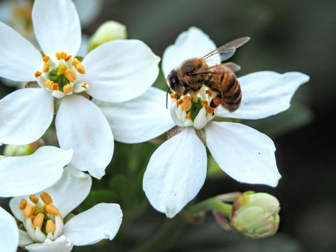
The relationship between early-blooming plants and native solitary bees depends on timing. Flowers must provide pollen and nectar when bees are active, while bees must be present to pollinate flowers during their receptive period. A few unusually warm days can shift one partner faster than the other, creating a gap that may be difficult to see without careful records. That is why the naturalist’s role matters. A consistent field note can reveal a gradual change long before a dramatic weather headline makes the pattern obvious. By linking observations to a native pollinator monitoring guide, community observers can turn local attention into useful stewardship data.

Two pink wildflowers blooming against a dark leafy background
Careful records of first bloom and pollinator emergence reveal whether a local spring is keeping ecological partners in step.

The Biology of Mismatch in Early Season Mutualisms

Plants and insects do not read the same seasonal signals. Many woody plants respond strongly to accumulated warmth, often described as growing degree days, while soil-nesting bees experience a more complicated set of conditions. Soil temperature, nest depth, moisture, winter survival, solar exposure, and the availability of food for developing larvae can all influence emergence. A warm spell may accelerate bud development on a south-facing shrub without warming a shaded nesting bank enough to release the bees that depend on its flowers.

This difference in thermal sensitivity can produce a phenological mismatch. Floral opening may outpace insect emergence, leaving early flowers with fewer visits during their brief peak. The reverse can also occur: bees may emerge during a warm interval, only to encounter closed flowers, cold rain, or a late frost. The problem is not always a complete separation of partners. A plant and its pollinator may still occupy the same garden or preserve, but their interaction can weaken because flowers offer less accessible pollen, bees encounter fewer suitable blossoms, or activity periods overlap for fewer hours.

Specialized early-season pollinators face the narrowest nutritional margins. Mining bees may collect pollen from a limited group of spring plants, while mason bees depend on a nearby sequence of blooms to provision nests efficiently. When a preferred plant flowers before females are active, the loss is not simply a missed visit. It can mean longer foraging flights, lower energy reserves, delayed nesting, and fewer well-provisioned offspring. A review of this wider issue, Global warming and plant-pollinator mismatches, explains that warming can disrupt mutualisms through changes in timing, behavior, morphology, resource quality, and attraction. The same review also emphasizes that generalist networks may show resilience because some pollinators can switch partners, although that flexibility does not protect every specialist.

  • Plant cues: accumulated heat, day length, winter chilling, soil moisture, and exposure to sunlight.
  • Bee cues: nest temperature, adult survival, larval development, local shelter, and the availability of pollen and nectar.
  • Landscape conditions: mowing, flooding, pesticide exposure, compacted soil, and the distance between nesting and flowering habitat.

Long-term evidence shows that change is measurable but not uniform. A study of museum and contemporary records for ten generalist bee species in northeastern North America found that bee activity advanced by an average of about 10.4 days between 1880 and 2010, with much of the shift occurring after 1970. Comparable plant records did not show a simple, universal divergence from bee timing. In some cases plants advanced faster, and in others bees did. That uncertainty is precisely why local monitoring matters. Broad averages can identify regional tendencies, but repeated observations at a particular preserve or garden reveal which relationships are most vulnerable there.

Standardized Protocols for Backyard and Trailside Observers

Reliable phenology does not require expensive equipment. It requires repeatable choices. Select several native perennial plants that are common enough to revisit and important enough to matter for local pollinators. Choose plants with different flowering periods, and record their exact location, habitat exposure, and approximate size. A plant beside a south-facing wall should not be treated as equivalent to the same species in a shaded woodland hollow.

  1. Mark the observation plants. Use a discreet label, map point, or photograph so the same individuals can be revisited. Record species, site conditions, elevation if relevant, and whether irrigation or maintenance affects the plant.
  2. Set a consistent observation window. Visit at roughly the same part of the day, preferably during peak solar hours when conditions are warm and dry. Note cloud cover, wind, temperature if available, and recent rain.
  3. Record floral phenophases. Distinguish swollen buds, first open flower, approximately one-quarter and three-quarter bloom, peak bloom, fading flowers, and terminal petal drop. Use clear definitions rather than impressions such as “looks nearly finished.”
  4. Survey pollinator activity without disturbing nests. Watch for several minutes before moving closer. Record whether bees are basking, collecting pollen, carrying dry or visibly packed loads, drinking nectar, investigating flowers, or entering soil cavities.
  5. Document effort and uncertainty. Write down the duration of the visit, the number of observers, weather interruptions, and identification confidence. A record marked “likely mining bee” is more valuable than an overconfident incorrect species name.

Observation windows should be calibrated around favorable foraging conditions, not merely convenience. Many solitary bees are far less visible during cool, overcast, or windy weather, even when flowers are open. A cold morning with no bee activity should not be interpreted as evidence that bees are absent. It is a measurement of conditions at that time. Repeating a visit after sunlight reaches the site can separate a weather effect from a true seasonal pattern.

Plant records become especially useful when phenophases are recorded separately for each individual. Note the first open flower, the date when several flowers are available, the date of maximum display, and the end of flowering. For bees, record abundance in cautious categories or counts, such as zero, one to five, six to twenty, or more than twenty individuals during a fixed observation period. Avoid handling bees or opening nests. Pollen visibility can be recorded as absent, uncertain, or clearly visible, with color and placement noted when possible.

The USA National Phenology Network provides a useful framework for thinking about spring onset through First Leaf, First Bloom, and Late Bloom indices. These modeled products combine historical observations with temperature and weather data, and they can be compared with direct Nature’s Notebook observations. Such frameworks remind observers that a phenology record is not a casual date in a diary. It is a structured measurement that becomes more powerful when the same definitions are used across places and years.

Connecting Local Notebooks to Regional Monitoring Networks

A notebook kept beside a garden path can contribute to regional science when it includes location, date, species, observation method, and confidence. Researchers can combine many such records to identify advancing spring conditions, compare elevations, test climate models, and locate places where habitat management should be prioritized. The value comes from accumulation. One observation may describe one plant, but hundreds of consistent observations can reveal whether a watershed is changing at the same pace as a regional model predicts.

Several monitoring approaches serve different purposes. Nature’s Notebook emphasizes standardized plant and animal life-cycle observations. The USA National Phenology Network also develops mapped spring indicators that help communicate broad seasonal conditions. Oregon Season Tracker combines plant phenology with precipitation measurements gathered by volunteers across urban, rural, and natural settings. Its community-based model, described in Oregon Season Tracker engages community to advance climate science, shows how local observations can support climate research, natural resource planning, and long-term ecological studies.

Monitoring approach Primary strength Useful observer practice
Nature’s Notebook Consistent life-cycle observations for plants and animals Use defined phenophases and revisit marked individuals
USA National Phenology Network indices Regional visualization of modeled spring onset Compare local dates with maps and long-term normals
Oregon Season Tracker Linked precipitation and native plant observations Follow equipment and recording standards carefully
Local stewardship logs Fine-scale habitat and pollinator context Record management, exposure, nesting habitat, and effort

Before submitting records, check four essentials: correct species identification, an unambiguous date, a precise location, and a description of the observation method. Photographs should include enough context to show the plant or habitat, not only a close-up of a flower. If the site was mowed, irrigated, burned, flooded, or treated with any pesticide, record that information. These details help analysts distinguish biological change from a management event.

Consistency across years is more important than collecting a large number of observations during one unusual spring. A five-minute visit every few days can produce a stronger time series than a single intensive survey. Keep the same plant markers, preserve original entries, and note missed visits rather than filling gaps from memory. Over time, the record can show whether flowering is becoming earlier, whether bee activity is compressed into a shorter window, or whether a late-season bloom is sustaining pollinators after an early flush has ended.

Practical Habitat Calibration for the Changing Seasons

Monitoring should lead to habitat decisions, but it should not be used to justify rushed intervention after every unusual weather event. The goal is a resilient sequence of resources. Plant for overlapping bloom periods rather than a single impressive flowering display. Include early native ephemerals, midseason perennials, shrubs, and late-season asters or other locally appropriate plants. A continuous sequence gives early-emerging bees alternatives when one species flowers too soon or is damaged by frost.

  • Protect cold-hardy native ephemerals and other early flowers that provide pollen before trees and summer perennials dominate.
  • Maintain several plant species in each flowering period so a single weather-sensitive species does not create a complete resource gap.
  • Leave undisturbed, well-drained bare ground for mining bees, avoiding unnecessary mulch, compaction, and spring digging.
  • Retain hollow stems, pithy stalks, leaf litter, and coarse woody material where they provide shelter for cavity-nesting or overwintering insects.
  • Reduce pesticide exposure, especially during active flowering and peak bee emergence.

Habitat calibration also means protecting transition windows. A municipal preserve may benefit from delayed mowing until observers confirm that early flowers have finished and ground-nesting bees have completed a critical activity period. A residential garden can leave a small patch of bare soil intact instead of covering every bed with dense mulch. Hollow stems can remain standing through winter and early spring, then be cut only after records or local guidance indicate that nesting activity has ended.

Management should respond to local evidence. If records show that flowers are consistently opening before pollinators appear, add more cold-tolerant native plants, protect sheltered nesting areas, and avoid removing leaf litter too early. If bees emerge while little is in bloom, prioritize early nectar and pollen sources and examine whether mowing or ornamental planting has eliminated the first seasonal resources. These adjustments are modest, but repeated across gardens, parks, school grounds, and rights-of-way, they can strengthen the connected habitat that native pollinators need.

Do not assume that earlier is always better. A plant that flowers unusually early may be exposed to frost, while a bee that emerges too soon may face cold rain and depleted food. The practical objective is diversity in timing and structure, not an artificially accelerated spring. Native plants with different responses to temperature, moisture, and day length can spread ecological risk across the season.

Transform Your Observations Into Resilient Habitats

The observant naturalist serves as an ecological anchor between daily experience and long-term conservation. A dated note about the first mason bee, the last open flower, or a week without suitable forage may appear small, but it preserves information that cannot be reconstructed later. When those notes use consistent methods, they become evidence of how a particular place is responding to changing seasons.

Begin before the next seasonal shift by selecting a few native plants, marking their locations, and preparing a simple field sheet with dates, phenophases, weather, pollinator activity, and management notes. Submit suitable records to a regional monitoring network, share patterns with local land managers, and use the results to refine planting and maintenance decisions. Stewardship becomes stronger when observation and action form a continuous loop: watch the season, document the change, protect the habitat, and return to see what follows.

The Forest Floor Network: How Underground Fungi Keep Woodlands Resilient

Beyond the Metaphor of the Underground Network

The phrase “wood wide web” has helped bring attention to the living soil beneath forests, but it can also make fungal ecology sound more mysterious and coordinated than it really is. Woodland fungi do not operate as a single underground internet with a central intelligence. They form physical networks of microscopic threads, called hyphae, that grow through soil, organic matter, and root tissues. Their effects are biological, measurable, and highly dependent on species, moisture, soil chemistry, disturbance, and seasonal conditions.

For community arborists, land conservationists, woodland owners, and regenerative land stewards, this distinction matters. Mycorrhizal fungi form partnerships with living roots. In exchange for plant-derived sugars, they help gather water and mineral nutrients from a much larger volume of soil than roots could explore alone. Protecting that partnership is not an ornamental addition to tree care. It is part of maintaining the physical soil structure, nutrient cycling, and drought tolerance on which a healthy canopy depends. The practical question is therefore not whether a woodland has an attractive fungal story, but whether its soil still provides the habitat in which fungal networks can grow, connect, and recover.

The Biology of Hyphae and Aggregate Soil Formation

Hyphae are fine, branching filaments that can move through pores between mineral particles, decaying leaves, dead wood, and root surfaces. A single fungal network may occupy an intricate three-dimensional space that is largely invisible from the surface. As hyphae extend, they physically bind particles together and create contact points between mineral soil and organic residues. This process contributes to the formation of aggregates, small clusters of soil particles that are more stable than loose grains.

Close-up of a delicate, branching fungal mycelium network
Healthy fungal partnerships help woodland soils retain water, cycle nutrients, and support resilient root systems.

Mycorrhizal roots reinforce this structure through both physical growth and chemistry. Fungi release compounds that help particles adhere, while decomposing fungal material adds organic carbon to the soil. Arbuscular mycorrhizal fungi are especially associated with glomalin-related soil proteins, a group of persistent compounds linked to aggregate stability. The term glomalin is sometimes used too broadly, and field measurements can be technically complex, but the management principle is clear: living roots, fungal biomass, and organic matter work together to build a more coherent soil matrix.

Stable aggregates create a useful pattern of pore spaces. Larger pores allow air movement and drainage, while smaller pores retain water that roots and microbes can access between rainfall events. This balance is essential in woodland soils, where roots need oxygen as well as moisture. Compaction collapses those spaces; bare soil can crust at the surface; and repeated disturbance can interrupt the continuity of hyphal growth. Studies documenting hyphal network dynamics are examining how fungal symbioses may help trees withstand drought, including research on Joshua trees exposed to increasing heat, prolonged dry periods, wildfire, and development pressure.

  • Hyphae extend the effective soil-exploring area of roots.
  • Fungal compounds and biomass help stabilize soil aggregates.
  • Aggregate structure supports both water retention and aeration.
  • Undisturbed organic layers provide food and habitat for fungal growth.

These benefits are not automatic. Fungal communities differ between sites, and a tree may not associate equally well with every available fungus. Local species, host compatibility, soil pH, temperature, and moisture all influence the outcome. That is why importing a generic inoculant cannot replace careful attention to native soil, existing vegetation, and the conditions that allow resident fungi to persist.

Resource Buffering and Water Transport in Stressed Canopy Systems

During a dry spell, a mycorrhizal network can help distribute access to water across the root zone, although it should not be treated as a guaranteed irrigation system. Fungal hyphae are narrower than roots and can enter small soil pores that roots cannot reach. In some ecosystems, water taken up in deeper or moister microsites may become available to plants connected to the fungal network. The broader process, often described as hydraulic redistribution, depends on soil continuity, fungal identity, root physiology, and the timing of water availability.

The exchange is also nutritional. Plants provide carbohydrates produced through photosynthesis, while fungi can assist with the acquisition of phosphorus, nitrogen, and micronutrients. Under a closed canopy, neighboring trees may compete for light, water, and minerals, yet fungal connections can also create pathways through which carbon and nutrients move. The direction and ecological importance of that movement vary widely, so managers should avoid assuming that every connected tree benefits equally. The reliable lesson is that a diverse, living root and fungal community gives the woodland more biological options when conditions change.

Ectomycorrhizal and arbuscular mycorrhizal fungi perform related partnership functions but occupy different biological niches. Matching management expectations to the dominant fungal type helps prevent oversimplified restoration plans.

Feature Ectomycorrhizal associations Arbuscular mycorrhizal associations
Common host groups Many oaks, birches, beeches, pines, and other woody plants Many grasses, herbs, shrubs, and tree species
Root relationship Fungi form a sheath around roots and grow between root cells Fungi enter root cells and form finely branched exchange structures
Typical soil role Strong involvement in organic matter and nitrogen acquisition in many woodland soils Important phosphorus acquisition and aggregate formation, especially in mineral soils
Management priority Retain woody litter, mature host trees, and intact forest floor habitat Protect living roots, reduce soil disturbance, and maintain diverse ground vegetation

Climate resilience is therefore a matter of buffering rather than invulnerability. A fungal partnership may improve access to scarce resources, but it cannot compensate indefinitely for severe root damage, a drained watershed, repeated canopy removal, or a soil profile stripped of organic matter. Research supported by the U.S. Bureau of Land Management on Joshua tree fungi reflects this practical uncertainty: scientists are testing whether fungal communities differ across climates, whether particular fungi improve drought resistance, and whether inoculation can assist restoration after fire or human disturbance.

Ground Disturbances That Sever Subterranean Architecture

Mechanical compaction is among the most persistent threats to woodland soil. Heavy machinery, repeated vehicle traffic, construction staging, and even frequent foot traffic on wet ground can compress aggregates and reduce pore connectivity. The damage may remain long after the surface appears stable. Roots encounter greater resistance, oxygen becomes less available, water may run off instead of infiltrating, and fungal hyphae lose the continuous pathways needed to colonize new root growth.

Tillage causes a different but related disruption. Turning soil breaks fungal filaments, exposes organic matter to rapid decomposition, and repeatedly resets the biological succession that supports woodland establishment. Synthetic fertilizer can also alter the partnership. High applications of readily available nitrogen or phosphorus may reduce a plant”s incentive to invest carbon in mycorrhizal fungi, leading to lower colonization in some settings. Fertilizer responses depend on dose, timing, soil type, and species, but routine application without soil testing can weaken rather than strengthen the biological system.

Former pasture presents an additional establishment barrier. Dense grasses compete directly with young saplings for moisture and nutrients, while their established root mats occupy much of the upper soil. A grassland may have abundant fungal life, but its dominant fungal community is not necessarily suited to newly planted woodland species. If the site has also been grazed heavily or compacted, young trees face both immediate competition and a degraded root environment. The transition requires more than placing seedlings in holes and waiting for a forest to appear.

  • Keep machinery off wet ground whenever possible.
  • Use permanent access routes rather than driving across the planting area.
  • Avoid broad tillage when targeted vegetation control can achieve the same goal.
  • Base fertilizer decisions on soil testing and identified deficiencies.
  • Inspect compacted zones before planting, especially near gateways, tracks, and livestock watering points.

Plastic mulch may suppress competing vegetation, but it can also create disposal problems, restrict gas exchange if poorly installed, and fragment into persistent pieces. Organic mulches require more careful sourcing and maintenance, yet they can feed soil organisms while allowing rainfall and air to move into the root zone. The appropriate choice depends on local climate, fire risk, available materials, and the ability to keep mulch away from direct contact with tree stems.

Actionable Field Principles for Woodland Stewards

Begin with observation rather than intervention. Map compaction, drainage, existing trees, ground vegetation, erosion, and areas where leaf litter or woody debris already accumulates. A simple soil pit can reveal whether aggregates crumble naturally, whether roots are concentrated near the surface, and whether compacted layers restrict drainage. Laboratory tests can add information about pH, organic matter, nutrients, and texture, but field structure and moisture behavior are equally important.

Low-impact preparation usually protects more biology than aggressive clearing. Flattening or cutting competing grass, opening small planting windows, and leaving undisturbed strips between rows can reduce competition without exposing the entire site. Locally sourced leaf litter, small branches, and coarse woody debris provide habitat for decomposers and help moderate temperature and moisture. Materials should be free of invasive seeds, contaminated soil, and chemical residues. Healthy woodland soil can contain useful native fungi, but moving soil between sites also carries pathogens and invasive organisms, so transfers should follow local biosecurity guidance.

Natural inoculation is often strongest when the site offers the right conditions. Moisture, woody carbon, living host roots, and shelter from repeated disturbance give local fungi an opportunity to colonize naturally. Commercial mycorrhizal products may have a role in specific restoration projects, especially where native inoculum has been lost, but product claims should be checked against the host species, fungal type, application method, and local evidence. More inoculum is not automatically better. Habitat quality determines whether introduced organisms survive.

  1. Assess the site before planting. Record soil texture, compaction, drainage, existing vegetation, erosion, and nearby woodland sources of native fungal communities.
  2. Reduce competition with minimal soil exposure. Cut, flatten, or selectively suppress grass around planting zones rather than cultivating the entire field.
  3. Build a breathable organic layer. Apply locally appropriate leaf litter, chips, sticks, and coarse woody debris in a broad, moderate layer, keeping material several inches away from trunks.
  4. Plant a diverse set of locally adapted hosts. Species diversity supports a wider range of root and fungal partnerships and reduces dependence on one climate-sensitive tree.
  5. Protect moisture and soil continuity. Use contour-based water management where appropriate, maintain access alleys, and prevent machinery traffic across wet ground.
  6. Monitor through multiple seasons. Check survival, shoot growth, leaf color, soil moisture, mulch decomposition, browsing, and competing vegetation. Adjust gradually rather than disturbing the whole site again.

On former pasture, a sequential approach is especially valuable. First stabilize runoff and reduce compaction. Then establish mulch and woody habitat before or alongside planting, allowing fungal and invertebrate communities to develop. Protect young trees from grass competition and browsing, but retain some ground cover to prevent erosion. As roots expand, spacing and management should encourage connection between planting groups while preserving open areas for access and future thinning.

Coarse woody debris deserves particular attention. Logs, branches, and mixed-size chips decompose at different rates, creating a long-term sequence of moisture pockets, fungal habitat, and nutrient release. Fine mulch alone can mat or decompose quickly; large logs alone may not protect the immediate root zone. A mixture often works better, provided it does not create excessive fire risk or harbor pests near valuable trees. In community projects, this material can often be sourced from local pruning operations, turning an unavoidable waste stream into a soil-building resource.

Cultivating Woodlands from the Ground Downward

Resilient woodland management begins with a change in emphasis. Tree planting is visible and easy to count, but survival depends on less visible conditions: connected pores, stable aggregates, living roots, organic residues, and fungal partners suited to the site. A sapling installed in compacted, biologically depleted soil may receive excellent aftercare and still struggle. A sapling planted into a protected, well-structured root zone has a stronger foundation from which to respond to heat, drought, competition, and seasonal variability.

The next practical step is a hands-on soil health assessment. Walk the site after rain and during a dry period. Dig small inspection pits, examine root distribution, look for earthworms and fungal threads, test whether water infiltrates or ponds, and identify where machinery or livestock have altered the ground. Protect the areas that already function well, repair damaged zones slowly, and treat every mulch layer, access route, and planting decision as part of the woodland”s subterranean architecture. Climate resilience is built from the ground downward, one intact soil aggregate and one preserved hyphal pathway at a time.

Listening to the Forest: How Acoustic Monitoring Detects Biodiversity Shifts Before Sight Catches Up

When the Forest Goes Quiet Before the Trees Fall

A forest can appear intact while its ecological fabric is already beginning to loosen. The canopy may remain green, trails may look unchanged, and a conventional walk-through survey may record little more than familiar species. Yet the first signs of stress often emerge in the sounds between the trees: fewer dawn choruses, altered frog calls, reduced insect activity, or a growing dominance of traffic, machinery, and other human noise. For community land managers, these changes matter because they can precede obvious habitat loss by years.

Passive acoustic monitoring provides a way to detect those early shifts without repeatedly entering sensitive habitat or disturbing wildlife. Small autonomous recorders can collect scheduled samples through the day and night, creating a continuous ecological record that human observers cannot match. A compact wildlife acoustic recorder can help document birds, amphibians, insects, and other vocal animals while the forest continues its ordinary rhythms. When recordings are compared across seasons and years, subtle changes in the soundscape can reveal fragmentation, drought stress, altered species activity, and declining ecological resilience before canopy degradation becomes visible.

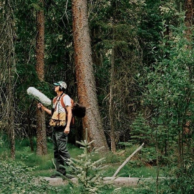
Person carrying a large microphone through a dense forest
Regular sound recordings can reveal ecological stress early, giving communities time to investigate and protect vulnerable habitat.

Decoding the Forest Soundscape

A forest soundscape is not simply a collection of pleasant natural noises. It is an ecological record made up of several overlapping sources. Biophony refers to sounds produced by living organisms, including bird song, frog calls, insect choruses, mammal vocalizations, and sometimes the movement or feeding activity of animals. Geophony includes nonliving natural sounds such as rainfall, running water, wind through foliage, and thunder. Anthrophony describes human-generated sound, from roads and aircraft to chainsaws, recreation, voices, and distant industrial activity.

Separating these components helps land stewards ask better questions. A reduction in biophony may indicate fewer animals, changed breeding behavior, or a shift in the timing of activity. A rise in anthrophony can mask calls even when species remain present, potentially changing where animals feed, mate, or raise young. Geophony provides essential context because wind, rain, and stream flow strongly influence what a recorder captures on any given day. Soundscape ecology therefore works best through repeated measurement rather than isolated recordings.

The acoustic niche hypothesis offers another useful framework. It proposes that species sharing an environment can reduce competition by occupying different acoustic spaces, such as separate frequency bands, time periods, or locations. In a healthy forest, one species may call in the low-frequency range at dawn while another uses a higher frequency later in the morning. Insects may dominate the afternoon, and amphibians may become prominent after rainfall. When habitat complexity declines, that layered arrangement can simplify. Fewer species may be active, calls may become less diverse, or human noise may occupy the same frequencies used by wildlife.

  • Acoustic diversity describes how many distinct sound types occur and how evenly they are represented.
  • Acoustic complexity reflects variation across frequencies and time, often offering a broad indicator of biological activity.
  • Acoustic similarity helps compare one recording period or habitat patch with another and can expose gradual changes that individual listeners miss.

An Acoustic Complexity Index, or ACI, is one commonly used measure. It evaluates variation in sound intensity across frequency bands and time intervals. A complex, active soundscape may produce a different index pattern from a quiet, heavily disturbed, or biologically simplified site. The measure is not a direct species count, and it should never replace field knowledge. However, when interpreted alongside species detections, weather records, vegetation surveys, and land-use information, it can provide a practical signal of habitat condition. Recent work on soundscape visualization, including research published in Frontiers in Ecology and Evolution, demonstrates how automated clustering and acoustic similarity can reveal daily patterns and relationships among complex sound events.

Comparing Visual Surveys and Acoustic Monitoring

Visual point-counts remain valuable. An experienced observer can identify behavior, inspect vegetation, notice tracks, and distinguish species that produce similar sounds. However, point-counts are typically limited to daylight hours, suitable weather, accessible locations, and the endurance of the survey team. Detection also depends on observer skill and position. A quiet bird in dense foliage may be missed, while a loud individual close to the observer may receive disproportionate attention. Repeating surveys across large community forests can become expensive and difficult to coordinate.

Autonomous recorders extend coverage rather than making field observers unnecessary. They can sample before sunrise, during nocturnal amphibian activity, and through periods when staff are unavailable. Units such as the Song Meter Mini 2 AA are advertised with up to 530 hours of deployment using eight AA alkaline batteries, along with weather-resistant housing and a tripod mount. Specifications and field settings should always be checked against the manufacturer”s current recorder guidance. The broader monitoring principle is straightforward: standardized recording creates a repeatable archive that can be revisited as identification tools improve.

Monitoring consideration Visual point-counts Passive acoustic monitoring
Time coverage Usually short, scheduled daytime visits Scheduled sampling across day and night
Labor demand Requires trained observers in the field Requires deployment, maintenance, and later analysis
Disturbance People may alter animal behavior or flush wildlife Generally non-invasive once installed
Spatial limits Restricted by observer access and audibility Multiple units can cover remote or difficult terrain
Early-warning value Strong when repeated by skilled observers Strong for detecting timing, activity, and soundscape shifts over time

The strongest programs combine both approaches. Acoustic data can flag a decline in frog activity at a wetland edge, for example, while a field visit investigates water levels, vegetation, disease, or nearby disturbance. Visual surveys then help verify whether the acoustic change reflects fewer animals, altered calling behavior, or simply unfavorable recording conditions. Guidance and applied research collected by the US Forest Service Science You Can Use collection similarly emphasizes translating monitoring information into decisions that land managers can apply.

Field Guide to Deploying Passive Acoustic Units

Deployment quality determines whether recordings become useful evidence or an expensive pile of difficult-to-interpret files. Begin with the ecological question, not the equipment. A unit intended for songbirds may need a different microphone position and sampling schedule from one intended for frogs or bats. Consider the target species, expected calling distance, seasonal activity, prevailing wind, rainfall exposure, and nearby sources of mechanical noise.

Height and microhabitat matter. Mounting a recorder too low can increase the sound of footsteps, small mammals, and ground-level vegetation movement. Mounting it too high may reduce detection of low-calling amphibians or make maintenance difficult. Canopy shelter can protect equipment from direct rain and intense sunlight, but dense foliage can also block or absorb sound. Avoid placing the microphone directly beside a moving branch, stream splash, road, or fence unless that feature is specifically part of the study. Record the exact location, height, orientation, date, habitat description, and equipment settings so later comparisons remain defensible.

Battery intervals and sampling frequencies should match the biology. Continuous recording creates a rich archive but consumes storage and power quickly. Scheduled samples, such as several minutes every hour, may provide adequate trend data while extending deployment. Higher sample rates are necessary for high-frequency taxa, while lower rates may be appropriate for many birds, frogs, and larger mammals. Pilot tests are essential. A short trial can reveal wind distortion, microphone saturation, weak batteries, or excessive background noise before equipment is left unattended.

  1. Define the monitoring question. Identify the indicator taxa, seasons, habitats, and management decisions that the recordings should inform.
  2. Select representative locations. Include reference areas, habitat edges, disturbed sites, and restoration areas where comparisons can reveal change.
  3. Standardize installation. Use consistent height, orientation, recording schedule, file format, and metadata. Photograph each installation and log weather conditions.
  4. Inspect and review. Check batteries, housings, memory cards, and microphones on a planned schedule. Listen to test files before scaling up and document every adjustment.

Community stewardship benefits from simple standards that everyone can follow. A shared deployment form, common file naming system, and map of recorder locations can prevent confusion when volunteers, conservation groups, and land agencies contribute data. Place units where they can be secured without damaging trees, and consider theft, flooding, fire, and wildlife interference. The goal is not to collect the greatest possible volume of audio. It is to create a reliable seasonal baseline against which meaningful change can be recognized.

Translating Audio Files into Actionable Stewardship

Large acoustic projects quickly generate more recordings than a person can review manually. Automated sound identification algorithms can scan files for likely bird, frog, insect, or mammal calls and highlight periods that deserve attention. Acoustic indices can summarize activity, while clustering tools can group similar sound events and reveal changes in daily timing. These methods save labor, but they are not infallible. Wind, rain, overlapping calls, microphone differences, and unfamiliar regional vocalizations can produce false positives or missed detections.

Human validation remains especially important for unusual records and management decisions. Community volunteers can be trained to review a small set of flagged clips, label confidence levels, and identify recurring sources of confusion. This creates a useful partnership between automated processing and local knowledge. A teacher, birder, ranger, or long-term resident may recognize a call pattern that a general-purpose algorithm has not learned. Careful validation also gives volunteers a direct role in stewardship rather than treating monitoring as data collection alone.

  • Establish a baseline. Compare the same sites across equivalent seasons before interpreting a single unusual week.
  • Track indicator vocalizations. Select species linked to wetlands, mature forest, riparian habitat, or other management priorities.
  • Investigate sustained declines. Check weather, equipment performance, vegetation, water conditions, predators, disease, and nearby noise before assigning a cause.
  • Connect findings to decisions. Adjust restoration timing, restrict disruptive activities during breeding periods, protect quiet refuges, or prioritize follow-up surveys.

If indicator vocalizations dwindle across several monitoring periods, management should respond proportionately and quickly. A decline in nocturnal frog calls may justify checking drainage, water quality, and breeding pools. Reduced dawn bird activity along a forest edge may prompt an assessment of lighting, traffic, invasive vegetation, or corridor connectivity. Acoustic monitoring does not explain every ecological change by itself, but it can shorten the distance between warning and investigation. That speed is often the difference between preventing a problem and documenting damage after it has become visible.

Tune Your Land Management to the Unseen Frequencies

Passive acoustic monitoring closes an important gap between visible destruction and early ecological decline. Trees may stand for decades after the community of insects, birds, and amphibians around them has begun to change. A soundscape can register altered activity, disrupted timing, and growing human pressure while there is still time to protect habitat, restore connectivity, or reduce disturbance. Used carefully, acoustic evidence strengthens rather than replaces field observation, local ecological knowledge, and direct habitat assessment.

Start with one seasonal pilot in a clearly defined habitat. Choose a small number of representative sites, establish a consistent recording schedule, document weather and equipment settings, and review a manageable sample of files with trained community members. Repeat the process across the same period next year. Over time, those recordings can become a local ecological archive, supporting restoration plans, education, grant applications, and practical decisions about access and land use. Listening attentively is not passive. It is a disciplined form of stewardship that helps communities notice change early enough to act.

Why Nature Conservancies Need an Intranet

Although an unsung hero, an intranet is a powerful employee tool for any organization. And while many people associate it with clunky software of the nineties, the world of work has evolved over time since then. What we have today is easy-to-navigate internal networks with up-to-date files that make work easier, rather than inhibit it.

When it comes to nature conservancies, intranets can significantly enhance employee efficiency and effectiveness, and they are a vital tool for fostering collaboration, streamlining processes, and promoting engagement among employees and volunteers. Here are some compelling reasons why a nature conservancy should have an intranet.

Facilitates Information Sharing

It goes without saying that nature conservancies deal with huge amounts of information, including research papers, conservation strategies, and educational materials and guidelines. This is where Omnia intranet comes in. It can serve as a digital library that houses essential documents and resources in a single and easy-to-access location. This ensures that very team member can find information quickly when they need it.

Improves Communication

Effective communication is crucial in any organisation, and nature conservancies are no exception. Again, Omnia intranet provides a central platform where staff can easily share updates, ideas, and resources. This not only reduces the chances of miscommunication but also nurtures a collaborative spirit among teams.

Good for Proper Data Management

With nature conservancies often collecting vast amounts of data related to conservation efforts, research findings, community engagements, etc., an intranet can streamline data collection, storage, and reporting processes, making it easy to manage and analyse information. This is especially important when it comes to tracking the impacts of various initiatives and communicating the results to stakeholders, donors, and the public at large.

Pet-Friendly Ikea Karlstad Sofa Covers

Do you have a furry pal back at home and would like to add to their comfort while maximizing playtime? Get durable, affordable and luxurious Ikea Karlstad sofa covers that your dog or cat will love. Most available options are smooth, hindering your pet from destroying them with their claws and teeth.

What’s more, the stunning Ikea Karlstad sofa covers come in various fabrics, ranging from cotton and linen to velvet, corduroy, Bemz Conscious and wool. These reversible pieces of protective cloth are also super easy to install, and they have zippers, so you’re assured of a clean look.

The Animal World

Animals of North America

People who live in North America may incorrectly assume that the wildlife in this region is not very exotic. However, this is simply not true. There is a wide range of interesting creatures found across North American land. The continent is home to a plethora of unique native species.

Bears

North America has become the home of several different bear types. News sites such as the BBC infrequently report incidents of bear attacks on humans. This tends to occur when people stumble into their territory.

Black bear populations are very widely distributed. They have been seen as far north as Canada and as far south as Mexico. Grizzly bears tend to live in the north. This includes Alaska and the Northern Rocky Mountains. It is even possible to see polar bears in colder parts of the continent.

Moose

The moose can be found in cold regions such as Washington and Maine. They are very tall and can run fast for their size. The moose is a vegetarian that survives on a diet of bark, twigs and leaves. However, this does not mean that they are docile in nature. In fact, the moose attacks human beings far more often than bears or wolves. When they feel threatened, they will charge at a person, inflicting potentially deadly injuries.

American Bison

The American bison is regularly mistaken for the buffalo. They once roamed the plains of North America in huge herds. They were the staple diet of numerous native human tribes. However, the bison population has diminished significantly in the last two centuries. People who want to see these creatures can find them in protected reserves and national parks. This includes Yellowstone.

Grey Wolf

The grey wolf is one of the largest examples of wild canine. In human minds, they have often been misunderstood as malevolent creatures. This has led to them being hunted in large numbers. In fact, they were wiped out in the United Kingdom. There have been attempts in North America to conserve the species. They have been found in Wisconsin, Michigan, Wyoming, Idaho and Montana.

Bobcat

There are bobcat populations throughout much of North America. However, they are not often spotted. This is due to their shy and nocturnal nature. A bobcat is roughly double the size of a house cat. They are fierce hunters which can take down prey larger than themselves.

Florida Manatee

These animals are related to the elephant. They are aquatic in nature and like to live in shallow warm waters. This makes Florida the ideal place for them. The manatee is sometimes referred to as a “sea cow”. This is because they can spend up to 8 hours a day eating sea grass.

Animals of Africa

People will often visit the continent of Africa solely to see the amazing wildlife that inhabits it. In fact, a large tourist industry has grown around African safari trips. The untamed wilderness is home to some of the most intriguing species on Earth.

Lions

When people think of African animals, they will often imagine this “king of the jungle”. There are plenty of fascinating creatures to look out for whilst in Africa. However, few are more interesting than this predator. It roams the grasslands and savannah.

Cheetahs

The cheetah is known for its immense speed. It is the worlds fastest mammal, able to reach 60 miles per hour in around 3 seconds. These animals can be seen in sub-Saharan Africa.

Rhinoceros

In Africa, there are two rhino species: the black and the white. Black rhinos live in Kenya, Zimbabwe, Namibia and South Africa. Meanwhile, white rhinos can be found mainly in South Africa. However, there are also small numbers in Swaziland, Namibia, Botswana and Zimbabwe. Both types have become targets of poachers. This has led to them becoming endangered species.

Elephants

The African elephant is known as the largest of Earth’s land animals. They have been known to grow to 13 feet tall. Adults can weigh thousands of pounds. Both the males and females are able to grow tusks. These are used to dig for sources of food and water.

Leopards

These wild cats have distinctive spotty markings. They are known to be very elusive. Much of their time is spent sitting in trees. This is where they drag their prey back to eat. Leopards are native to over 35 countries within Africa.

Mountain Gorillas

Mountain gorillas are endangered with under 900 of them still in existence. They live in groups of 30 with one dominant male leading them. Groups such as this are known as “troops”. These creatures can only be found within the national parks of Rwanda, Uganda and the DRC.

Cape Buffalo

If people are interested in seeing African animals of immense size, then they should seek out the cape buffalo. They are massive creatures that roam in large herds. Despite their seemingly docile nature, they are as dangerous as hippos and crocodiles. This is because they are known to trample humans when confronted.

Animals of Asia

There is a diverse amount of flora within Asia that is home to plenty of animal species. Jungles and mountains have an abundance of particularly unique creatures.

Giant Panda

These are one of the most well known types of bear in all of Asia. They live in mountains throughout central China. The online information site Wikipedia has articles discussing efforts to save this endangered species. There are currently only around 1000 giant pandas in existence. Many of them are kept in captivity for conservation purposes.

Asian Elephant

The Asian elephant is significantly smaller in size compared to its African counterparts. These creatures live in herds within tropical forests. They are most commonly found in Sri Lanka, India and southern regions of China. Within a herd, the largest and oldest of the females tend to be the leader. Once a male reaches maturity, they may leave the herd.

Orangutan

The orangutan is a highly intelligent species of primate. Some have been seen utilizing tools and constructing elaborate nests. They are also known for their huge arm spans. From fingertip to fingertip, a 5-ft male may have an arm span of 7 ft. These creatures can be found within Sumatra and Borneo. Deforestation currently threatens orangutan populations.

King Cobra

The king cobra is the longest venomous snake on earth. Adults have been known to reach lengths of over 13 ft. Within India, the king cobra has an important cultural significance. It also has a fearsome reputation as these snakes can deliver a deadly bite when provoked. Large amounts of antivenom may be needed to stop the painful symptoms. Luckily, king cobras are naturally shy and avoid confrontation.