Phenology in Practice: Documenting the Shifting Calendars of Native Pollinators

When Spring Arrives Ahead of Its Gardeners

Spring rarely announces itself with a single dramatic event. It gathers quietly along a forest floor, in the swelling buds of a backyard shrub, and in the first warm hours when a solitary bee leaves its sheltered nest. A trout lily opens after sunlight reaches its petals. A maple unfurls leaves. A small mining bee appears above a patch of bare soil. Each observation is modest on its own, yet together these events form a local seasonal calendar. Recording that calendar is a practical way to understand how weather and climate are reshaping the living landscape.

The relationship between early-blooming plants and native solitary bees depends on timing. Flowers must provide pollen and nectar when bees are active, while bees must be present to pollinate flowers during their receptive period. A few unusually warm days can shift one partner faster than the other, creating a gap that may be difficult to see without careful records. That is why the naturalist’s role matters. A consistent field note can reveal a gradual change long before a dramatic weather headline makes the pattern obvious. By linking observations to a native pollinator monitoring guide, community observers can turn local attention into useful stewardship data.
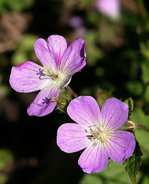
Two pink wildflowers blooming against a dark leafy background
Careful records of first bloom and pollinator emergence reveal whether a local spring is keeping ecological partners in step.

The Biology of Mismatch in Early Season Mutualisms

Plants and insects do not read the same seasonal signals. Many woody plants respond strongly to accumulated warmth, often described as growing degree days, while soil-nesting bees experience a more complicated set of conditions. Soil temperature, nest depth, moisture, winter survival, solar exposure, and the availability of food for developing larvae can all influence emergence. A warm spell may accelerate bud development on a south-facing shrub without warming a shaded nesting bank enough to release the bees that depend on its flowers.

This difference in thermal sensitivity can produce a phenological mismatch. Floral opening may outpace insect emergence, leaving early flowers with fewer visits during their brief peak. The reverse can also occur: bees may emerge during a warm interval, only to encounter closed flowers, cold rain, or a late frost. The problem is not always a complete separation of partners. A plant and its pollinator may still occupy the same garden or preserve, but their interaction can weaken because flowers offer less accessible pollen, bees encounter fewer suitable blossoms, or activity periods overlap for fewer hours.

Specialized early-season pollinators face the narrowest nutritional margins. Mining bees may collect pollen from a limited group of spring plants, while mason bees depend on a nearby sequence of blooms to provision nests efficiently. When a preferred plant flowers before females are active, the loss is not simply a missed visit. It can mean longer foraging flights, lower energy reserves, delayed nesting, and fewer well-provisioned offspring. A review of this wider issue, Global warming and plant-pollinator mismatches, explains that warming can disrupt mutualisms through changes in timing, behavior, morphology, resource quality, and attraction. The same review also emphasizes that generalist networks may show resilience because some pollinators can switch partners, although that flexibility does not protect every specialist.

  • Plant cues: accumulated heat, day length, winter chilling, soil moisture, and exposure to sunlight.
  • Bee cues: nest temperature, adult survival, larval development, local shelter, and the availability of pollen and nectar.
  • Landscape conditions: mowing, flooding, pesticide exposure, compacted soil, and the distance between nesting and flowering habitat.

Long-term evidence shows that change is measurable but not uniform. A study of museum and contemporary records for ten generalist bee species in northeastern North America found that bee activity advanced by an average of about 10.4 days between 1880 and 2010, with much of the shift occurring after 1970. Comparable plant records did not show a simple, universal divergence from bee timing. In some cases plants advanced faster, and in others bees did. That uncertainty is precisely why local monitoring matters. Broad averages can identify regional tendencies, but repeated observations at a particular preserve or garden reveal which relationships are most vulnerable there.

Standardized Protocols for Backyard and Trailside Observers

Reliable phenology does not require expensive equipment. It requires repeatable choices. Select several native perennial plants that are common enough to revisit and important enough to matter for local pollinators. Choose plants with different flowering periods, and record their exact location, habitat exposure, and approximate size. A plant beside a south-facing wall should not be treated as equivalent to the same species in a shaded woodland hollow.

  1. Mark the observation plants. Use a discreet label, map point, or photograph so the same individuals can be revisited. Record species, site conditions, elevation if relevant, and whether irrigation or maintenance affects the plant.
  2. Set a consistent observation window. Visit at roughly the same part of the day, preferably during peak solar hours when conditions are warm and dry. Note cloud cover, wind, temperature if available, and recent rain.
  3. Record floral phenophases. Distinguish swollen buds, first open flower, approximately one-quarter and three-quarter bloom, peak bloom, fading flowers, and terminal petal drop. Use clear definitions rather than impressions such as “looks nearly finished.”
  4. Survey pollinator activity without disturbing nests. Watch for several minutes before moving closer. Record whether bees are basking, collecting pollen, carrying dry or visibly packed loads, drinking nectar, investigating flowers, or entering soil cavities.
  5. Document effort and uncertainty. Write down the duration of the visit, the number of observers, weather interruptions, and identification confidence. A record marked “likely mining bee” is more valuable than an overconfident incorrect species name.

Observation windows should be calibrated around favorable foraging conditions, not merely convenience. Many solitary bees are far less visible during cool, overcast, or windy weather, even when flowers are open. A cold morning with no bee activity should not be interpreted as evidence that bees are absent. It is a measurement of conditions at that time. Repeating a visit after sunlight reaches the site can separate a weather effect from a true seasonal pattern.

Plant records become especially useful when phenophases are recorded separately for each individual. Note the first open flower, the date when several flowers are available, the date of maximum display, and the end of flowering. For bees, record abundance in cautious categories or counts, such as zero, one to five, six to twenty, or more than twenty individuals during a fixed observation period. Avoid handling bees or opening nests. Pollen visibility can be recorded as absent, uncertain, or clearly visible, with color and placement noted when possible.

The USA National Phenology Network provides a useful framework for thinking about spring onset through First Leaf, First Bloom, and Late Bloom indices. These modeled products combine historical observations with temperature and weather data, and they can be compared with direct Nature’s Notebook observations. Such frameworks remind observers that a phenology record is not a casual date in a diary. It is a structured measurement that becomes more powerful when the same definitions are used across places and years.

Connecting Local Notebooks to Regional Monitoring Networks

A notebook kept beside a garden path can contribute to regional science when it includes location, date, species, observation method, and confidence. Researchers can combine many such records to identify advancing spring conditions, compare elevations, test climate models, and locate places where habitat management should be prioritized. The value comes from accumulation. One observation may describe one plant, but hundreds of consistent observations can reveal whether a watershed is changing at the same pace as a regional model predicts.

Several monitoring approaches serve different purposes. Nature’s Notebook emphasizes standardized plant and animal life-cycle observations. The USA National Phenology Network also develops mapped spring indicators that help communicate broad seasonal conditions. Oregon Season Tracker combines plant phenology with precipitation measurements gathered by volunteers across urban, rural, and natural settings. Its community-based model, described in Oregon Season Tracker engages community to advance climate science, shows how local observations can support climate research, natural resource planning, and long-term ecological studies.

Monitoring approach Primary strength Useful observer practice
Nature’s Notebook Consistent life-cycle observations for plants and animals Use defined phenophases and revisit marked individuals
USA National Phenology Network indices Regional visualization of modeled spring onset Compare local dates with maps and long-term normals
Oregon Season Tracker Linked precipitation and native plant observations Follow equipment and recording standards carefully
Local stewardship logs Fine-scale habitat and pollinator context Record management, exposure, nesting habitat, and effort

Before submitting records, check four essentials: correct species identification, an unambiguous date, a precise location, and a description of the observation method. Photographs should include enough context to show the plant or habitat, not only a close-up of a flower. If the site was mowed, irrigated, burned, flooded, or treated with any pesticide, record that information. These details help analysts distinguish biological change from a management event.

Consistency across years is more important than collecting a large number of observations during one unusual spring. A five-minute visit every few days can produce a stronger time series than a single intensive survey. Keep the same plant markers, preserve original entries, and note missed visits rather than filling gaps from memory. Over time, the record can show whether flowering is becoming earlier, whether bee activity is compressed into a shorter window, or whether a late-season bloom is sustaining pollinators after an early flush has ended.

Practical Habitat Calibration for the Changing Seasons

Monitoring should lead to habitat decisions, but it should not be used to justify rushed intervention after every unusual weather event. The goal is a resilient sequence of resources. Plant for overlapping bloom periods rather than a single impressive flowering display. Include early native ephemerals, midseason perennials, shrubs, and late-season asters or other locally appropriate plants. A continuous sequence gives early-emerging bees alternatives when one species flowers too soon or is damaged by frost.

  • Protect cold-hardy native ephemerals and other early flowers that provide pollen before trees and summer perennials dominate.
  • Maintain several plant species in each flowering period so a single weather-sensitive species does not create a complete resource gap.
  • Leave undisturbed, well-drained bare ground for mining bees, avoiding unnecessary mulch, compaction, and spring digging.
  • Retain hollow stems, pithy stalks, leaf litter, and coarse woody material where they provide shelter for cavity-nesting or overwintering insects.
  • Reduce pesticide exposure, especially during active flowering and peak bee emergence.

Habitat calibration also means protecting transition windows. A municipal preserve may benefit from delayed mowing until observers confirm that early flowers have finished and ground-nesting bees have completed a critical activity period. A residential garden can leave a small patch of bare soil intact instead of covering every bed with dense mulch. Hollow stems can remain standing through winter and early spring, then be cut only after records or local guidance indicate that nesting activity has ended.

Management should respond to local evidence. If records show that flowers are consistently opening before pollinators appear, add more cold-tolerant native plants, protect sheltered nesting areas, and avoid removing leaf litter too early. If bees emerge while little is in bloom, prioritize early nectar and pollen sources and examine whether mowing or ornamental planting has eliminated the first seasonal resources. These adjustments are modest, but repeated across gardens, parks, school grounds, and rights-of-way, they can strengthen the connected habitat that native pollinators need.

Do not assume that earlier is always better. A plant that flowers unusually early may be exposed to frost, while a bee that emerges too soon may face cold rain and depleted food. The practical objective is diversity in timing and structure, not an artificially accelerated spring. Native plants with different responses to temperature, moisture, and day length can spread ecological risk across the season.

Transform Your Observations Into Resilient Habitats

The observant naturalist serves as an ecological anchor between daily experience and long-term conservation. A dated note about the first mason bee, the last open flower, or a week without suitable forage may appear small, but it preserves information that cannot be reconstructed later. When those notes use consistent methods, they become evidence of how a particular place is responding to changing seasons.

Begin before the next seasonal shift by selecting a few native plants, marking their locations, and preparing a simple field sheet with dates, phenophases, weather, pollinator activity, and management notes. Submit suitable records to a regional monitoring network, share patterns with local land managers, and use the results to refine planting and maintenance decisions. Stewardship becomes stronger when observation and action form a continuous loop: watch the season, document the change, protect the habitat, and return to see what follows.


The Forest Floor Network: How Underground Fungi Keep Woodlands Resilient

Beyond the Metaphor of the Underground Network

The phrase “wood wide web” has helped bring attention to the living soil beneath forests, but it can also make fungal ecology sound more mysterious and coordinated than it really is. Woodland fungi do not operate as a single underground internet with a central intelligence. They form physical networks of microscopic threads, called hyphae, that grow through soil, organic matter, and root tissues. Their effects are biological, measurable, and highly dependent on species, moisture, soil chemistry, disturbance, and seasonal conditions.

For community arborists, land conservationists, woodland owners, and regenerative land stewards, this distinction matters. Mycorrhizal fungi form partnerships with living roots. In exchange for plant-derived sugars, they help gather water and mineral nutrients from a much larger volume of soil than roots could explore alone. Protecting that partnership is not an ornamental addition to tree care. It is part of maintaining the physical soil structure, nutrient cycling, and drought tolerance on which a healthy canopy depends. The practical question is therefore not whether a woodland has an attractive fungal story, but whether its soil still provides the habitat in which fungal networks can grow, connect, and recover.

The Biology of Hyphae and Aggregate Soil Formation

Hyphae are fine, branching filaments that can move through pores between mineral particles, decaying leaves, dead wood, and root surfaces. A single fungal network may occupy an intricate three-dimensional space that is largely invisible from the surface. As hyphae extend, they physically bind particles together and create contact points between mineral soil and organic residues. This process contributes to the formation of aggregates, small clusters of soil particles that are more stable than loose grains.

Close-up of a delicate, branching fungal mycelium network
Healthy fungal partnerships help woodland soils retain water, cycle nutrients, and support resilient root systems.

Mycorrhizal roots reinforce this structure through both physical growth and chemistry. Fungi release compounds that help particles adhere, while decomposing fungal material adds organic carbon to the soil. Arbuscular mycorrhizal fungi are especially associated with glomalin-related soil proteins, a group of persistent compounds linked to aggregate stability. The term glomalin is sometimes used too broadly, and field measurements can be technically complex, but the management principle is clear: living roots, fungal biomass, and organic matter work together to build a more coherent soil matrix.

Stable aggregates create a useful pattern of pore spaces. Larger pores allow air movement and drainage, while smaller pores retain water that roots and microbes can access between rainfall events. This balance is essential in woodland soils, where roots need oxygen as well as moisture. Compaction collapses those spaces; bare soil can crust at the surface; and repeated disturbance can interrupt the continuity of hyphal growth. Studies documenting hyphal network dynamics are examining how fungal symbioses may help trees withstand drought, including research on Joshua trees exposed to increasing heat, prolonged dry periods, wildfire, and development pressure.

  • Hyphae extend the effective soil-exploring area of roots.
  • Fungal compounds and biomass help stabilize soil aggregates.
  • Aggregate structure supports both water retention and aeration.
  • Undisturbed organic layers provide food and habitat for fungal growth.

These benefits are not automatic. Fungal communities differ between sites, and a tree may not associate equally well with every available fungus. Local species, host compatibility, soil pH, temperature, and moisture all influence the outcome. That is why importing a generic inoculant cannot replace careful attention to native soil, existing vegetation, and the conditions that allow resident fungi to persist.

Resource Buffering and Water Transport in Stressed Canopy Systems

During a dry spell, a mycorrhizal network can help distribute access to water across the root zone, although it should not be treated as a guaranteed irrigation system. Fungal hyphae are narrower than roots and can enter small soil pores that roots cannot reach. In some ecosystems, water taken up in deeper or moister microsites may become available to plants connected to the fungal network. The broader process, often described as hydraulic redistribution, depends on soil continuity, fungal identity, root physiology, and the timing of water availability.

The exchange is also nutritional. Plants provide carbohydrates produced through photosynthesis, while fungi can assist with the acquisition of phosphorus, nitrogen, and micronutrients. Under a closed canopy, neighboring trees may compete for light, water, and minerals, yet fungal connections can also create pathways through which carbon and nutrients move. The direction and ecological importance of that movement vary widely, so managers should avoid assuming that every connected tree benefits equally. The reliable lesson is that a diverse, living root and fungal community gives the woodland more biological options when conditions change.

Ectomycorrhizal and arbuscular mycorrhizal fungi perform related partnership functions but occupy different biological niches. Matching management expectations to the dominant fungal type helps prevent oversimplified restoration plans.

Feature Ectomycorrhizal associations Arbuscular mycorrhizal associations
Common host groups Many oaks, birches, beeches, pines, and other woody plants Many grasses, herbs, shrubs, and tree species
Root relationship Fungi form a sheath around roots and grow between root cells Fungi enter root cells and form finely branched exchange structures
Typical soil role Strong involvement in organic matter and nitrogen acquisition in many woodland soils Important phosphorus acquisition and aggregate formation, especially in mineral soils
Management priority Retain woody litter, mature host trees, and intact forest floor habitat Protect living roots, reduce soil disturbance, and maintain diverse ground vegetation

Climate resilience is therefore a matter of buffering rather than invulnerability. A fungal partnership may improve access to scarce resources, but it cannot compensate indefinitely for severe root damage, a drained watershed, repeated canopy removal, or a soil profile stripped of organic matter. Research supported by the U.S. Bureau of Land Management on Joshua tree fungi reflects this practical uncertainty: scientists are testing whether fungal communities differ across climates, whether particular fungi improve drought resistance, and whether inoculation can assist restoration after fire or human disturbance.

Ground Disturbances That Sever Subterranean Architecture

Mechanical compaction is among the most persistent threats to woodland soil. Heavy machinery, repeated vehicle traffic, construction staging, and even frequent foot traffic on wet ground can compress aggregates and reduce pore connectivity. The damage may remain long after the surface appears stable. Roots encounter greater resistance, oxygen becomes less available, water may run off instead of infiltrating, and fungal hyphae lose the continuous pathways needed to colonize new root growth.

Tillage causes a different but related disruption. Turning soil breaks fungal filaments, exposes organic matter to rapid decomposition, and repeatedly resets the biological succession that supports woodland establishment. Synthetic fertilizer can also alter the partnership. High applications of readily available nitrogen or phosphorus may reduce a plant”s incentive to invest carbon in mycorrhizal fungi, leading to lower colonization in some settings. Fertilizer responses depend on dose, timing, soil type, and species, but routine application without soil testing can weaken rather than strengthen the biological system.

Former pasture presents an additional establishment barrier. Dense grasses compete directly with young saplings for moisture and nutrients, while their established root mats occupy much of the upper soil. A grassland may have abundant fungal life, but its dominant fungal community is not necessarily suited to newly planted woodland species. If the site has also been grazed heavily or compacted, young trees face both immediate competition and a degraded root environment. The transition requires more than placing seedlings in holes and waiting for a forest to appear.

  • Keep machinery off wet ground whenever possible.
  • Use permanent access routes rather than driving across the planting area.
  • Avoid broad tillage when targeted vegetation control can achieve the same goal.
  • Base fertilizer decisions on soil testing and identified deficiencies.
  • Inspect compacted zones before planting, especially near gateways, tracks, and livestock watering points.

Plastic mulch may suppress competing vegetation, but it can also create disposal problems, restrict gas exchange if poorly installed, and fragment into persistent pieces. Organic mulches require more careful sourcing and maintenance, yet they can feed soil organisms while allowing rainfall and air to move into the root zone. The appropriate choice depends on local climate, fire risk, available materials, and the ability to keep mulch away from direct contact with tree stems.

Actionable Field Principles for Woodland Stewards

Begin with observation rather than intervention. Map compaction, drainage, existing trees, ground vegetation, erosion, and areas where leaf litter or woody debris already accumulates. A simple soil pit can reveal whether aggregates crumble naturally, whether roots are concentrated near the surface, and whether compacted layers restrict drainage. Laboratory tests can add information about pH, organic matter, nutrients, and texture, but field structure and moisture behavior are equally important.

Low-impact preparation usually protects more biology than aggressive clearing. Flattening or cutting competing grass, opening small planting windows, and leaving undisturbed strips between rows can reduce competition without exposing the entire site. Locally sourced leaf litter, small branches, and coarse woody debris provide habitat for decomposers and help moderate temperature and moisture. Materials should be free of invasive seeds, contaminated soil, and chemical residues. Healthy woodland soil can contain useful native fungi, but moving soil between sites also carries pathogens and invasive organisms, so transfers should follow local biosecurity guidance.

Natural inoculation is often strongest when the site offers the right conditions. Moisture, woody carbon, living host roots, and shelter from repeated disturbance give local fungi an opportunity to colonize naturally. Commercial mycorrhizal products may have a role in specific restoration projects, especially where native inoculum has been lost, but product claims should be checked against the host species, fungal type, application method, and local evidence. More inoculum is not automatically better. Habitat quality determines whether introduced organisms survive.

  1. Assess the site before planting. Record soil texture, compaction, drainage, existing vegetation, erosion, and nearby woodland sources of native fungal communities.
  2. Reduce competition with minimal soil exposure. Cut, flatten, or selectively suppress grass around planting zones rather than cultivating the entire field.
  3. Build a breathable organic layer. Apply locally appropriate leaf litter, chips, sticks, and coarse woody debris in a broad, moderate layer, keeping material several inches away from trunks.
  4. Plant a diverse set of locally adapted hosts. Species diversity supports a wider range of root and fungal partnerships and reduces dependence on one climate-sensitive tree.
  5. Protect moisture and soil continuity. Use contour-based water management where appropriate, maintain access alleys, and prevent machinery traffic across wet ground.
  6. Monitor through multiple seasons. Check survival, shoot growth, leaf color, soil moisture, mulch decomposition, browsing, and competing vegetation. Adjust gradually rather than disturbing the whole site again.

On former pasture, a sequential approach is especially valuable. First stabilize runoff and reduce compaction. Then establish mulch and woody habitat before or alongside planting, allowing fungal and invertebrate communities to develop. Protect young trees from grass competition and browsing, but retain some ground cover to prevent erosion. As roots expand, spacing and management should encourage connection between planting groups while preserving open areas for access and future thinning.

Coarse woody debris deserves particular attention. Logs, branches, and mixed-size chips decompose at different rates, creating a long-term sequence of moisture pockets, fungal habitat, and nutrient release. Fine mulch alone can mat or decompose quickly; large logs alone may not protect the immediate root zone. A mixture often works better, provided it does not create excessive fire risk or harbor pests near valuable trees. In community projects, this material can often be sourced from local pruning operations, turning an unavoidable waste stream into a soil-building resource.

Cultivating Woodlands from the Ground Downward

Resilient woodland management begins with a change in emphasis. Tree planting is visible and easy to count, but survival depends on less visible conditions: connected pores, stable aggregates, living roots, organic residues, and fungal partners suited to the site. A sapling installed in compacted, biologically depleted soil may receive excellent aftercare and still struggle. A sapling planted into a protected, well-structured root zone has a stronger foundation from which to respond to heat, drought, competition, and seasonal variability.

The next practical step is a hands-on soil health assessment. Walk the site after rain and during a dry period. Dig small inspection pits, examine root distribution, look for earthworms and fungal threads, test whether water infiltrates or ponds, and identify where machinery or livestock have altered the ground. Protect the areas that already function well, repair damaged zones slowly, and treat every mulch layer, access route, and planting decision as part of the woodland”s subterranean architecture. Climate resilience is built from the ground downward, one intact soil aggregate and one preserved hyphal pathway at a time.

Listening to the Forest: How Acoustic Monitoring Detects Biodiversity Shifts Before Sight Catches Up

When the Forest Goes Quiet Before the Trees Fall

A forest can appear intact while its ecological fabric is already beginning to loosen. The canopy may remain green, trails may look unchanged, and a conventional walk-through survey may record little more than familiar species. Yet the first signs of stress often emerge in the sounds between the trees: fewer dawn choruses, altered frog calls, reduced insect activity, or a growing dominance of traffic, machinery, and other human noise. For community land managers, these changes matter because they can precede obvious habitat loss by years.

Passive acoustic monitoring provides a way to detect those early shifts without repeatedly entering sensitive habitat or disturbing wildlife. Small autonomous recorders can collect scheduled samples through the day and night, creating a continuous ecological record that human observers cannot match. A compact wildlife acoustic recorder can help document birds, amphibians, insects, and other vocal animals while the forest continues its ordinary rhythms. When recordings are compared across seasons and years, subtle changes in the soundscape can reveal fragmentation, drought stress, altered species activity, and declining ecological resilience before canopy degradation becomes visible.

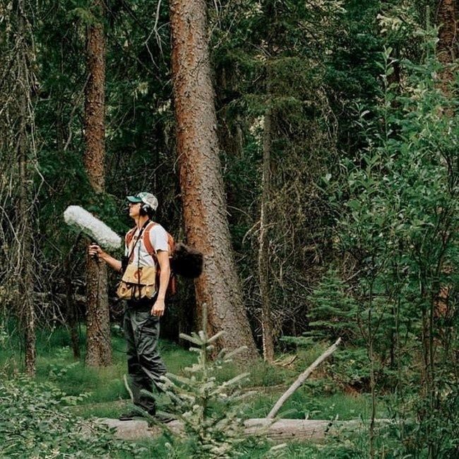
Person carrying a large microphone through a dense forest
Regular sound recordings can reveal ecological stress early, giving communities time to investigate and protect vulnerable habitat.

Decoding the Forest Soundscape

A forest soundscape is not simply a collection of pleasant natural noises. It is an ecological record made up of several overlapping sources. Biophony refers to sounds produced by living organisms, including bird song, frog calls, insect choruses, mammal vocalizations, and sometimes the movement or feeding activity of animals. Geophony includes nonliving natural sounds such as rainfall, running water, wind through foliage, and thunder. Anthrophony describes human-generated sound, from roads and aircraft to chainsaws, recreation, voices, and distant industrial activity.

Separating these components helps land stewards ask better questions. A reduction in biophony may indicate fewer animals, changed breeding behavior, or a shift in the timing of activity. A rise in anthrophony can mask calls even when species remain present, potentially changing where animals feed, mate, or raise young. Geophony provides essential context because wind, rain, and stream flow strongly influence what a recorder captures on any given day. Soundscape ecology therefore works best through repeated measurement rather than isolated recordings.

The acoustic niche hypothesis offers another useful framework. It proposes that species sharing an environment can reduce competition by occupying different acoustic spaces, such as separate frequency bands, time periods, or locations. In a healthy forest, one species may call in the low-frequency range at dawn while another uses a higher frequency later in the morning. Insects may dominate the afternoon, and amphibians may become prominent after rainfall. When habitat complexity declines, that layered arrangement can simplify. Fewer species may be active, calls may become less diverse, or human noise may occupy the same frequencies used by wildlife.

  • Acoustic diversity describes how many distinct sound types occur and how evenly they are represented.
  • Acoustic complexity reflects variation across frequencies and time, often offering a broad indicator of biological activity.
  • Acoustic similarity helps compare one recording period or habitat patch with another and can expose gradual changes that individual listeners miss.

An Acoustic Complexity Index, or ACI, is one commonly used measure. It evaluates variation in sound intensity across frequency bands and time intervals. A complex, active soundscape may produce a different index pattern from a quiet, heavily disturbed, or biologically simplified site. The measure is not a direct species count, and it should never replace field knowledge. However, when interpreted alongside species detections, weather records, vegetation surveys, and land-use information, it can provide a practical signal of habitat condition. Recent work on soundscape visualization, including research published in Frontiers in Ecology and Evolution, demonstrates how automated clustering and acoustic similarity can reveal daily patterns and relationships among complex sound events.

Comparing Visual Surveys and Acoustic Monitoring

Visual point-counts remain valuable. An experienced observer can identify behavior, inspect vegetation, notice tracks, and distinguish species that produce similar sounds. However, point-counts are typically limited to daylight hours, suitable weather, accessible locations, and the endurance of the survey team. Detection also depends on observer skill and position. A quiet bird in dense foliage may be missed, while a loud individual close to the observer may receive disproportionate attention. Repeating surveys across large community forests can become expensive and difficult to coordinate.

Autonomous recorders extend coverage rather than making field observers unnecessary. They can sample before sunrise, during nocturnal amphibian activity, and through periods when staff are unavailable. Units such as the Song Meter Mini 2 AA are advertised with up to 530 hours of deployment using eight AA alkaline batteries, along with weather-resistant housing and a tripod mount. Specifications and field settings should always be checked against the manufacturer”s current recorder guidance. The broader monitoring principle is straightforward: standardized recording creates a repeatable archive that can be revisited as identification tools improve.

Monitoring consideration Visual point-counts Passive acoustic monitoring
Time coverage Usually short, scheduled daytime visits Scheduled sampling across day and night
Labor demand Requires trained observers in the field Requires deployment, maintenance, and later analysis
Disturbance People may alter animal behavior or flush wildlife Generally non-invasive once installed
Spatial limits Restricted by observer access and audibility Multiple units can cover remote or difficult terrain
Early-warning value Strong when repeated by skilled observers Strong for detecting timing, activity, and soundscape shifts over time

The strongest programs combine both approaches. Acoustic data can flag a decline in frog activity at a wetland edge, for example, while a field visit investigates water levels, vegetation, disease, or nearby disturbance. Visual surveys then help verify whether the acoustic change reflects fewer animals, altered calling behavior, or simply unfavorable recording conditions. Guidance and applied research collected by the US Forest Service Science You Can Use collection similarly emphasizes translating monitoring information into decisions that land managers can apply.

Field Guide to Deploying Passive Acoustic Units

Deployment quality determines whether recordings become useful evidence or an expensive pile of difficult-to-interpret files. Begin with the ecological question, not the equipment. A unit intended for songbirds may need a different microphone position and sampling schedule from one intended for frogs or bats. Consider the target species, expected calling distance, seasonal activity, prevailing wind, rainfall exposure, and nearby sources of mechanical noise.

Height and microhabitat matter. Mounting a recorder too low can increase the sound of footsteps, small mammals, and ground-level vegetation movement. Mounting it too high may reduce detection of low-calling amphibians or make maintenance difficult. Canopy shelter can protect equipment from direct rain and intense sunlight, but dense foliage can also block or absorb sound. Avoid placing the microphone directly beside a moving branch, stream splash, road, or fence unless that feature is specifically part of the study. Record the exact location, height, orientation, date, habitat description, and equipment settings so later comparisons remain defensible.

Battery intervals and sampling frequencies should match the biology. Continuous recording creates a rich archive but consumes storage and power quickly. Scheduled samples, such as several minutes every hour, may provide adequate trend data while extending deployment. Higher sample rates are necessary for high-frequency taxa, while lower rates may be appropriate for many birds, frogs, and larger mammals. Pilot tests are essential. A short trial can reveal wind distortion, microphone saturation, weak batteries, or excessive background noise before equipment is left unattended.

  1. Define the monitoring question. Identify the indicator taxa, seasons, habitats, and management decisions that the recordings should inform.
  2. Select representative locations. Include reference areas, habitat edges, disturbed sites, and restoration areas where comparisons can reveal change.
  3. Standardize installation. Use consistent height, orientation, recording schedule, file format, and metadata. Photograph each installation and log weather conditions.
  4. Inspect and review. Check batteries, housings, memory cards, and microphones on a planned schedule. Listen to test files before scaling up and document every adjustment.

Community stewardship benefits from simple standards that everyone can follow. A shared deployment form, common file naming system, and map of recorder locations can prevent confusion when volunteers, conservation groups, and land agencies contribute data. Place units where they can be secured without damaging trees, and consider theft, flooding, fire, and wildlife interference. The goal is not to collect the greatest possible volume of audio. It is to create a reliable seasonal baseline against which meaningful change can be recognized.

Translating Audio Files into Actionable Stewardship

Large acoustic projects quickly generate more recordings than a person can review manually. Automated sound identification algorithms can scan files for likely bird, frog, insect, or mammal calls and highlight periods that deserve attention. Acoustic indices can summarize activity, while clustering tools can group similar sound events and reveal changes in daily timing. These methods save labor, but they are not infallible. Wind, rain, overlapping calls, microphone differences, and unfamiliar regional vocalizations can produce false positives or missed detections.

Human validation remains especially important for unusual records and management decisions. Community volunteers can be trained to review a small set of flagged clips, label confidence levels, and identify recurring sources of confusion. This creates a useful partnership between automated processing and local knowledge. A teacher, birder, ranger, or long-term resident may recognize a call pattern that a general-purpose algorithm has not learned. Careful validation also gives volunteers a direct role in stewardship rather than treating monitoring as data collection alone.

  • Establish a baseline. Compare the same sites across equivalent seasons before interpreting a single unusual week.
  • Track indicator vocalizations. Select species linked to wetlands, mature forest, riparian habitat, or other management priorities.
  • Investigate sustained declines. Check weather, equipment performance, vegetation, water conditions, predators, disease, and nearby noise before assigning a cause.
  • Connect findings to decisions. Adjust restoration timing, restrict disruptive activities during breeding periods, protect quiet refuges, or prioritize follow-up surveys.

If indicator vocalizations dwindle across several monitoring periods, management should respond proportionately and quickly. A decline in nocturnal frog calls may justify checking drainage, water quality, and breeding pools. Reduced dawn bird activity along a forest edge may prompt an assessment of lighting, traffic, invasive vegetation, or corridor connectivity. Acoustic monitoring does not explain every ecological change by itself, but it can shorten the distance between warning and investigation. That speed is often the difference between preventing a problem and documenting damage after it has become visible.

Tune Your Land Management to the Unseen Frequencies

Passive acoustic monitoring closes an important gap between visible destruction and early ecological decline. Trees may stand for decades after the community of insects, birds, and amphibians around them has begun to change. A soundscape can register altered activity, disrupted timing, and growing human pressure while there is still time to protect habitat, restore connectivity, or reduce disturbance. Used carefully, acoustic evidence strengthens rather than replaces field observation, local ecological knowledge, and direct habitat assessment.

Start with one seasonal pilot in a clearly defined habitat. Choose a small number of representative sites, establish a consistent recording schedule, document weather and equipment settings, and review a manageable sample of files with trained community members. Repeat the process across the same period next year. Over time, those recordings can become a local ecological archive, supporting restoration plans, education, grant applications, and practical decisions about access and land use. Listening attentively is not passive. It is a disciplined form of stewardship that helps communities notice change early enough to act.